Kapandríti geodata
Kapandríti (Attica) is a populated place; located in Greece in Europe/Athens (GMT+3) time zone. With population of 3,359 people, there are 321 cities with bigger population in this country. Compared to other cities in Greece, 67.7% of cities are located further ↑North; 75.7% of cities are located further ←West and 83.8% of cities have lower elevation than Kapandríti. Note1
Administrative division(s):
- Level 1: Attica
- Level 2: Nomarchía Anatolikís Attikís
- Level 3: Dimos Oropos


Kapandríti GPS coordinates[2]
38° 12' 56.844" North, 23° 52' 45.768" East
| Map corner | latitude | longitude |
|---|---|---|
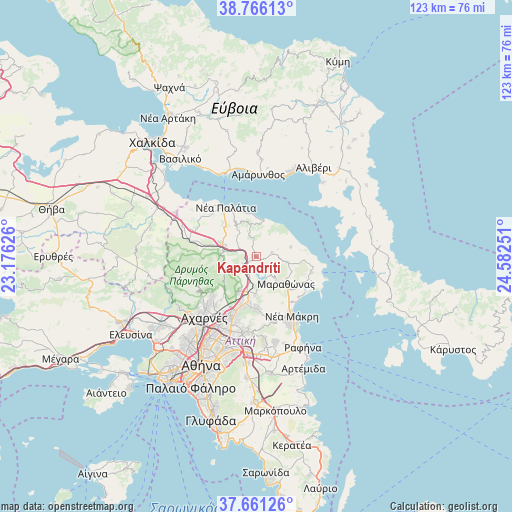
| Upper-left | 38.76613°, | 23.17626° |
| Center: | 38.21579°, | 23.87938° |
| Lower-right: | 37.66126°, | 24.58251° |
| Map W x H: | 122.9×122.8 km | = 76.4×76.3mi |
| max Lat: | 41.72048° ⇑67.7% North |
| Kapandríti: | 38.21579° |
| min Lat: | ⇓32.3% South 34.8346° |
| min Long | Kapandríti | max Long |
| 19.40494° | 23.87938° | 29.59361° |
| W 75.7%⇐ | ⇒24.3% E |
Elevation
Elevation of Kapandríti is 351 m = 1152 ft, and this is 182.1 m = 597 ft above average elevation for this country.
| Max E: |
1439 m = 4721 ft | 16.2% |
| Kapandríti | 351 m 1152 ft | |
| Avg. | 168.9 m = 554 ft | |
Min E: |
0 m = 0 ft | 83.8% |
See also: Greece elevation on elevation.city.
Geographical zone
Kapandríti is located in North temperate zone (between Tropic of Cancer and the Arctic Circle). Distance of this Northern Tropic circle is 1643.3 km =1021.1 mi to South.| Distance of | km | miles | from Kapandríti |
|---|---|---|---|
| North Pole | 5757.9 | 3577.8 | to North |
| Arctic Circle | 3152 | 1958.6 | to North |
| Tropic Cancer | 1643.3 | 1021.1 | to South |
| Equator | 4249.2 | 2640.3 | to South |


Nearby cities:
15 places around Kapandríti: (largest is in red/bold)
• Afidnés
3.7 km =2.3 mi,  248°
248°
• Agía Triáda
6.8 km =4.2 mi,  258°
258°
• Anoixi
9.4 km =5.8 mi,  191°
191°
• Grammatikó
7.6 km =4.7 mi,  101°
101°
• Kryonéri
9.7 km =6 mi,  206°
206°
• Kálamos
7.8 km =4.8 mi,  349°
349°
• Malakása
7.3 km =4.5 mi,  289°
289°
• Marathónas
10.1 km =6.3 mi,  133°
133°
• Markópoulo Oropoú
9.5 km =5.9 mi,  329°
329°
• Mikrokhórion
2.3 km =1.4 mi,  31°
31°
• Polydéndri
1 km =0.6 mi,  271°
271°
• Stamáta
10 km =6.2 mi,  179°
179°
• Varnávas
3.9 km =2.4 mi,  77°
77°
• Ágios Stéfanos
8 km =5 mi, 194°
• Áyioi Apóstoloi
8.9 km =5.5 mi,  17°
17°
Sources, notices
• [Note1] Compared only with cities in Greece existing in our database
• [Src1] Map data: © OpenStreetMap contributors (CC-BY-SA)
• [Src2] Other city data from geonames.org with taken over terms of usage.
• [Src3] Geographical zone / Annual Mean Temperature by Robert A. Rohde @ Wikipedia
