Argostólion geodata
Argostólion (Ionian Islands) is a seat of a second-order administrative division; located in Greece in Europe/Athens (GMT+3) time zone. With population of 9,820 people, there are 144 cities with bigger population in this country. Compared to other cities in Greece, 68.3% of cities are located further ↑North; 96.5% of cities are located further →East and 98.8% of cities have higher elevation than Argostólion. Note1
Administrative division(s):
- Level 1: Ionian Islands
- Level 2: Nomós Kefallinías
- Level 3: Dimos Kefalonia


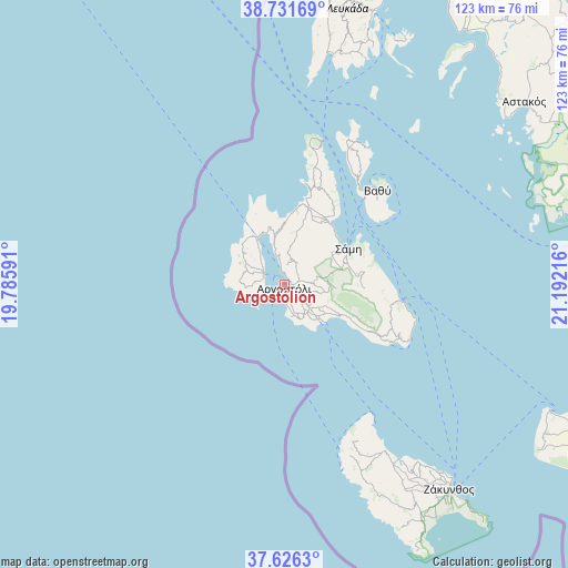
Argostólion GPS coordinates[2]
38° 10' 51.924" North, 20° 29' 20.508" East
| Map corner | latitude | longitude |
|---|---|---|
| Upper-left | 38.73169°, | 19.78591° |
| Center: | 38.18109°, | 20.48903° |
| Lower-right: | 37.6263°, | 21.19216° |
| Map W x H: | 122.9×122.9 km | = 76.4×76.4mi |
| max Lat: | 41.72048° ⇑68.3% North |
| Argostólion: | 38.18109° |
| min Lat: | ⇓31.7% South 34.8346° |
| min Long | Argostólion | max Long |
| 19.40494° | 20.48903° | 29.59361° |
| W 3.5%⇐ | ⇒96.5% E |
Elevation
Elevation of Argostólion is 2 m = 7 ft, and this is 166.9 m = 548 ft below average elevation for this country.
| Max E: |
1439 m = 4721 ft | 98.8% |
| Avg. | 168.9 m = 554 ft | |
| Argostólion | 2 m = 7 ft | |
Min E: |
0 m = 0 ft | 1.2% |
See also: Greece elevation on elevation.city.
Geographical zone
Argostólion is located in North temperate zone (between Tropic of Cancer and the Arctic Circle). Distance of this Northern Tropic circle is 1639.4 km =1018.7 mi to South.| Distance of | km | miles | from Argostólion |
|---|---|---|---|
| North Pole | 5761.7 | 3580.2 | to North |
| Arctic Circle | 3155.8 | 1960.9 | to North |
| Tropic Cancer | 1639.4 | 1018.7 | to South |
| Equator | 4245.3 | 2637.9 | to South |


Nearby cities:
15 places around Argostólion: (largest is in red/bold)
• Alónia
47.9 km =29.8 mi,  145°
145°
• Dilináta
5.3 km =3.3 mi,  26°
26°
• Itháki
28.6 km =17.8 mi,  44°
44°
• Kalipádhon
52.2 km =32.4 mi,  144°
144°
• Katastárion
45.6 km =28.3 mi, 148°
• Kipséli
49.8 km =30.9 mi, 144°
• Lixoúri
5.1 km =3.2 mi,  296°
296°
• Plános
52.2 km =32.4 mi, 140°
• Póros
24.9 km =15.5 mi,  97°
97°
• Skoulikádo
49.6 km =30.8 mi, 148°
• Sámi
15.8 km =9.8 mi,  60°
60°
• Tragákion
50.8 km =31.6 mi, 143°
• Valsamáta
8.3 km =5.2 mi,  93°
93°
• Vlacháta
13.6 km =8.5 mi,  118°
118°
• Áyios Dhimítrios
50.3 km =31.3 mi, 147°
Sources, notices
• [Note1] Compared only with cities in Greece existing in our database
• [Src1] Map data: © OpenStreetMap contributors (CC-BY-SA)
• [Src2] Other city data from geonames.org with taken over terms of usage.
• [Src3] Geographical zone / Annual Mean Temperature by Robert A. Rohde @ Wikipedia
