Toúmpa geodata
Toúmpa (Central Macedonia) is a populated place; located in Greece in Europe/Athens (GMT+3) time zone. With population of 576 people, there are 1635 cities with bigger population in this country. Compared to other cities in Greece, 92.9% of cities are located further ↓South; 70.2% of cities are located further ←West and 60.9% of cities have higher elevation than Toúmpa. Note1
Administrative division(s):
- Level 1: Central Macedonia
- Level 2: Nomós Serrón
- Level 3: Dimos Emmanouil Pappas


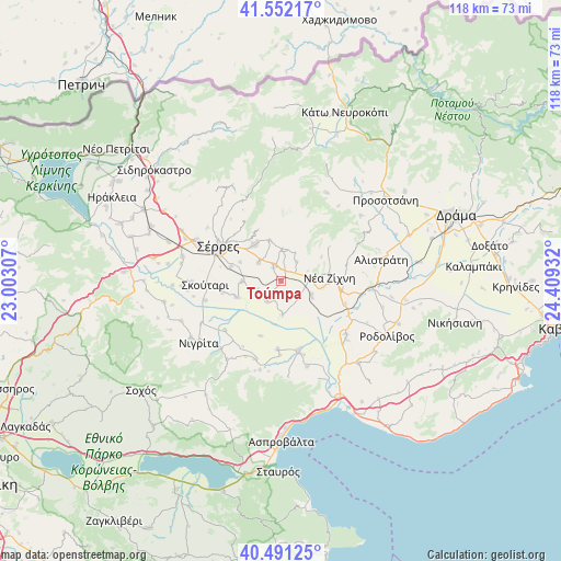
Toúmpa GPS coordinates[2]
41° 1' 25.86" North, 23° 42' 22.284" East
| Map corner | latitude | longitude |
|---|---|---|
| Upper-left | 41.55217°, | 23.00307° |
| Center: | 41.02385°, | 23.70619° |
| Lower-right: | 40.49125°, | 24.40932° |
| Map W x H: | 118×118 km | = 73.3×73.3mi |
| max Lat: | 41.72048° ⇑7.1% North |
| Toúmpa: | 41.02385° |
| min Lat: | ⇓92.9% South 34.8346° |
| min Long | Toúmpa | max Long |
| 19.40494° | 23.70619° | 29.59361° |
| W 70.2%⇐ | ⇒29.8% E |
Elevation
Elevation of Toúmpa is 47 m = 154 ft, and this is 121.9 m = 400 ft below average elevation for this country.
| Max E: |
1439 m = 4721 ft | 60.9% |
| Avg. | 168.9 m = 554 ft | |
| Toúmpa | 47 m = 154 ft | |
Min E: |
0 m = 0 ft | 39.1% |
See also: Greece elevation on elevation.city.
Geographical zone
Toúmpa is located in North temperate zone (between Tropic of Cancer and the Arctic Circle). Distance of this Northern Tropic circle is 1955.5 km =1215.1 mi to South.| Distance of | km | miles | from Toúmpa |
|---|---|---|---|
| North Pole | 5445.6 | 3383.7 | to North |
| Arctic Circle | 2839.7 | 1764.5 | to North |
| Tropic Cancer | 1955.5 | 1215.1 | to South |
| Equator | 4561.4 | 2834.3 | to South |


Nearby cities:
15 places around Toúmpa: (largest is in red/bold)
• Chrysó
6 km =3.7 mi,  309°
309°
• Emmanouíl Pappás
6.9 km =4.3 mi,  2°
2°
• Gázoros
5.8 km =3.6 mi,  88°
88°
• Monóvrysi
9.4 km =5.8 mi,  295°
295°
• Neochóri
11 km =6.8 mi,  286°
286°
• Néa Zíchni
10.3 km =6.4 mi,  84°
84°
• Néo Soúli
9.4 km =5.8 mi,  326°
326°
• Néos Skopós
8.1 km =5 mi,  270°
270°
• Oinoússa
11 km =6.8 mi,  322°
322°
• Paralímnio
5.3 km =3.3 mi,  215°
215°
• Pentápoli
3.3 km =2.1 mi, 333°
• Psychikó
6.8 km =4.2 mi,  251°
251°
• Tholós
6.9 km =4.3 mi,  112°
112°
• Valtotópi
9.8 km =6.1 mi, 249°
• Ágio Pnévma
8.9 km =5.5 mi,  345°
345°
Sources, notices
• [Note1] Compared only with cities in Greece existing in our database
• [Src1] Map data: © OpenStreetMap contributors (CC-BY-SA)
• [Src2] Other city data from geonames.org with taken over terms of usage.
• [Src3] Geographical zone / Annual Mean Temperature by Robert A. Rohde @ Wikipedia
