Thásos geodata
Thásos (East Macedonia and Thrace) is a seat of a third-order administrative division; located in Greece in Europe/Athens (GMT+3) time zone. With population of 3,234 people, there are 328 cities with bigger population in this country. Compared to other cities in Greece, 84.4% of cities are located further ↓South; 85.1% of cities are located further ←West and 94.2% of cities have higher elevation than Thásos. Note1
Administrative division(s):
- Level 1: East Macedonia and Thrace
- Level 2: Nomós Kaválas
- Level 3: Thasos


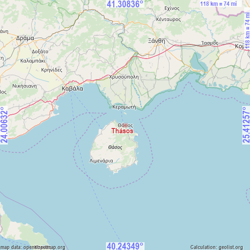
Thásos GPS coordinates[2]
40° 46' 41.016" North, 24° 42' 33.984" East
| Map corner | latitude | longitude |
|---|---|---|
| Upper-left | 41.30836°, | 24.00632° |
| Center: | 40.77806°, | 24.70944° |
| Lower-right: | 40.24349°, | 25.41257° |
| Map W x H: | 118.4×118.4 km | = 73.6×73.6mi |
| max Lat: | 41.72048° ⇑15.6% North |
| Thásos: | 40.77806° |
| min Lat: | ⇓84.4% South 34.8346° |
| min Long | Thásos | max Long |
| 19.40494° | 24.70944° | 29.59361° |
| W 85.1%⇐ | ⇒14.9% E |
Elevation
Elevation of Thásos is 6 m = 20 ft, and this is 162.9 m = 534 ft below average elevation for this country.
| Max E: |
1439 m = 4721 ft | 94.2% |
| Avg. | 168.9 m = 554 ft | |
| Thásos | 6 m = 20 ft | |
Min E: |
0 m = 0 ft | 5.8% |
See also: Greece elevation on elevation.city.
Geographical zone
Thásos is located in North temperate zone (between Tropic of Cancer and the Arctic Circle). Distance of this Northern Tropic circle is 1928.2 km =1198.1 mi to South.| Distance of | km | miles | from Thásos |
|---|---|---|---|
| North Pole | 5473 | 3400.8 | to North |
| Arctic Circle | 2867.1 | 1781.5 | to North |
| Tropic Cancer | 1928.2 | 1198.1 | to South |
| Equator | 4534.1 | 2817.4 | to South |


Nearby cities:
15 places around Thásos: (largest is in red/bold)
• Agíasma
15.1 km =9.4 mi,  342°
342°
• Chrysochóri
17.3 km =10.7 mi,  0°
0°
• Erateinó
20 km =12.4 mi, 343°
• Iliokentima
20.2 km =12.6 mi,  19°
19°
• Keramotí
8.7 km =5.4 mi,  358°
358°
• Limenária
20.2 km =12.6 mi,  213°
213°
• Néa Karyá
14.3 km =8.9 mi, 359°
• Panayía
5.5 km =3.4 mi,  163°
163°
• Pigés
14.6 km =9.1 mi,  347°
347°
• Potamiá
7.1 km =4.4 mi,  166°
166°
• Potós
20.4 km =12.7 mi,  204°
204°
• Prínos
11.8 km =7.3 mi,  249°
249°
• Skála Kalliráchis
16.8 km =10.4 mi,  241°
241°
• Theológos
13.3 km =8.3 mi,  186°
186°
• Ávato
22 km =13.7 mi, 21°
Sources, notices
• [Note1] Compared only with cities in Greece existing in our database
• [Src1] Map data: © OpenStreetMap contributors (CC-BY-SA)
• [Src2] Other city data from geonames.org with taken over terms of usage.
• [Src3] Geographical zone / Annual Mean Temperature by Robert A. Rohde @ Wikipedia
