Ólynthos geodata
Ólynthos (Central Macedonia) is a populated place; located in Greece in Europe/Athens (GMT+3) time zone. With population of 1,111 people, there are 908 cities with bigger population in this country. Compared to other cities in Greece, 70.1% of cities are located further ↓South; 61.1% of cities are located further ←West and 70% of cities have higher elevation than Ólynthos. Note1
Administrative division(s):
- Level 1: Central Macedonia
- Level 2: Nomós Chalkidikís
- Level 3: Dimos Polygyros


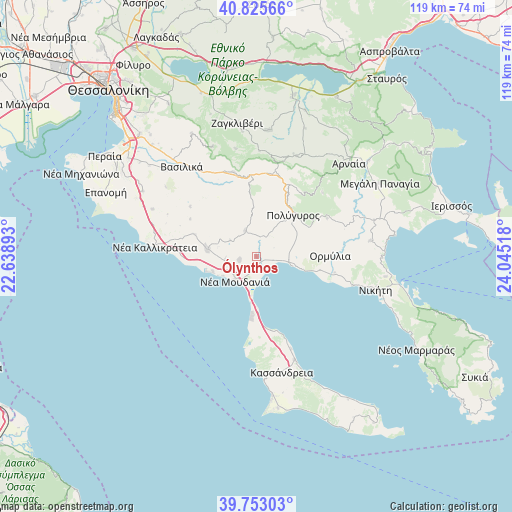
Ólynthos GPS coordinates[2]
40° 17' 29.292" North, 23° 20' 31.38" East
| Map corner | latitude | longitude |
|---|---|---|
| Upper-left | 40.82566°, | 22.63893° |
| Center: | 40.29147°, | 23.34205° |
| Lower-right: | 39.75303°, | 24.04518° |
| Map W x H: | 119.3×119.3 km | = 74.1×74.1mi |
| max Lat: | 41.72048° ⇑29.9% North |
| Ólynthos: | 40.29147° |
| min Lat: | ⇓70.1% South 34.8346° |
| min Long | Ólynthos | max Long |
| 19.40494° | 23.34205° | 29.59361° |
| W 61.1%⇐ | ⇒38.9% E |
Elevation
Elevation of Ólynthos is 31 m = 102 ft, and this is 137.9 m = 452 ft below average elevation for this country.
| Max E: |
1439 m = 4721 ft | 70% |
| Avg. | 168.9 m = 554 ft | |
| Ólynthos | 31 m = 102 ft | |
Min E: |
0 m = 0 ft | 30% |
See also: Greece elevation on elevation.city.
Geographical zone
Ólynthos is located in North temperate zone (between Tropic of Cancer and the Arctic Circle). Distance of this Northern Tropic circle is 1874.1 km =1164.5 mi to South.| Distance of | km | miles | from Ólynthos |
|---|---|---|---|
| North Pole | 5527.1 | 3434.4 | to North |
| Arctic Circle | 2921.2 | 1815.1 | to North |
| Tropic Cancer | 1874.1 | 1164.5 | to South |
| Equator | 4480 | 2783.7 | to South |


Nearby cities:
15 places around Ólynthos: (largest is in red/bold)
• Kalýves Polygýrou
4.1 km =2.5 mi,  97°
97°
• Néa Flogitá
10.8 km =6.7 mi,  251°
251°
• Néa Fókaia
18.2 km =11.3 mi,  164°
164°
• Néa Moudhaniá
7.2 km =4.5 mi,  222°
222°
• Néa Plágia
12.1 km =7.5 mi,  256°
256°
• Néa Poteídaia
10.9 km =6.8 mi,  186°
186°
• Néa Potídhaia
10.9 km =6.8 mi, 185°
• Néa Tríglia
11.6 km =7.2 mi,  277°
277°
• Ormýlia
17.1 km =10.6 mi,  88°
88°
• Paralía Dionysíou
9.1 km =5.7 mi,  239°
239°
• Polýgyros
12.7 km =7.9 mi,  41°
41°
• Portariá
4 km =2.5 mi, 258°
• Sozópoli
16.6 km =10.3 mi, 264°
• Símantra
6.6 km =4.1 mi,  335°
335°
• Ágios Mámas
3.6 km =2.2 mi, 188°
In other languages:
- In Spanish: Olinto
- In France: Olynthe
- In German: Olynth
- In Italian: Olinto
- In Russian: Олинф
Sources, notices
• [Note1] Compared only with cities in Greece existing in our database
• [Src1] Map data: © OpenStreetMap contributors (CC-BY-SA)
• [Src2] Other city data from geonames.org with taken over terms of usage.
• [Src3] Geographical zone / Annual Mean Temperature by Robert A. Rohde @ Wikipedia
