Chérso geodata
Chérso (Central Macedonia) is a populated place; located in Greece in Europe/Athens (GMT+3) time zone. With population of 814 people, there are 1259 cities with bigger population in this country. Compared to other cities in Greece, 95% of cities are located further ↓South; 52.3% of cities are located further →East and 55.5% of cities have lower elevation than Chérso. Note1


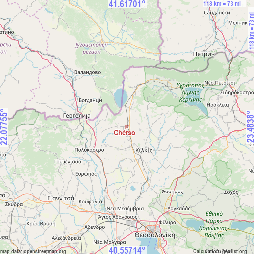
Chérso GPS coordinates[2]
41° 5' 21.156" North, 22° 46' 50.412" East
| Map corner | latitude | longitude |
|---|---|---|
| Upper-left | 41.61701°, | 22.07755° |
| Center: | 41.08921°, | 22.78067° |
| Lower-right: | 40.55714°, | 23.4838° |
| Map W x H: | 117.8×117.8 km | = 73.2×73.2mi |
| max Lat: | 41.72048° ⇑5% North |
| Chérso: | 41.08921° |
| min Lat: | ⇓95% South 34.8346° |
| min Long | Chérso | max Long |
| 19.40494° | 22.78067° | 29.59361° |
| W 47.7%⇐ | ⇒52.3% E |
Elevation
Elevation of Chérso is 100 m = 328 ft, and this is 68.9 m = 226 ft below average elevation for this country.
| Max E: |
1439 m = 4721 ft | 44.5% |
| Avg. | 168.9 m = 554 ft | |
| Chérso | 100 m = 328 ft | |
Min E: |
0 m = 0 ft | 55.5% |
See also: Greece elevation on elevation.city.
Geographical zone
Chérso is located in North temperate zone (between Tropic of Cancer and the Arctic Circle). Distance of this Northern Tropic circle is 1962.8 km =1219.6 mi to South.| Distance of | km | miles | from Chérso |
|---|---|---|---|
| North Pole | 5438.4 | 3379.3 | to North |
| Arctic Circle | 2832.5 | 1760 | to North |
| Tropic Cancer | 1962.8 | 1219.6 | to South |
| Equator | 4568.7 | 2838.9 | to South |


Nearby cities:
15 places around Chérso: (largest is in red/bold)
• Chorýgio
11.3 km =7 mi,  203°
203°
• Drosáto
8.8 km =5.5 mi,  12°
12°
• Efkarpía
10.8 km =6.7 mi,  99°
99°
• Kilkís
13.3 km =8.3 mi,  143°
143°
• Kristóni
15.8 km =9.8 mi,  155°
155°
• Mavronéri
22.6 km =14 mi,  173°
173°
• Mouriés
18.3 km =11.4 mi,  4°
4°
• Myriófyto
15.4 km =9.6 mi, 14°
• Néo Gynaikókastro
18.9 km =11.7 mi,  188°
188°
• Pedinó
21.4 km =13.3 mi, 158°
• Pefkodásos
18 km =11.2 mi,  251°
251°
• Polýkastro
20.6 km =12.8 mi,  239°
239°
• Pontoirákleia
13.4 km =8.3 mi,  277°
277°
• Stathmós Mourión
20 km =12.4 mi, 14°
• Vafiochóri
13.2 km =8.2 mi,  228°
228°
Sources, notices
• [Note1] Compared only with cities in Greece existing in our database
• [Src1] Map data: © OpenStreetMap contributors (CC-BY-SA)
• [Src2] Other city data from geonames.org with taken over terms of usage.
• [Src3] Geographical zone / Annual Mean Temperature by Robert A. Rohde @ Wikipedia
