Sai Kung geodata
Sai Kung is a seat of a first-order administrative division; located in Hong Kong in Asia/Hong_Kong (GMT+8) time zone. With population of 11,927 people, there are 8 cities with bigger population in this country. Compared to other cities in Hong Kong, 75% of cities are located further ↓South; 100% of cities are located further ←West and 68.8% of cities have lower elevation than Sai Kung. Note1


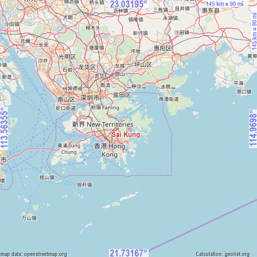
Sai Kung GPS coordinates[2]
22° 22' 59.988" North, 114° 16' 0.012" East
| Map corner | latitude | longitude |
|---|---|---|
| Upper-left | 23.03195°, | 113.56355° |
| Center: | 22.38333°, | 114.26667° |
| Lower-right: | 21.73167°, | 114.9698° |
| Map W x H: | 144.6×144.6 km | = 89.9×89.9mi |
| max Lat: | 22.45007° ⇑25% North |
| Sai Kung: | 22.38333° |
| min Lat: | ⇓75% South 22.20453° |
| min Long | Sai Kung | max Long |
| 113.86309° | 114.26667° | 114.26667° |
| W 100%⇐ | ⇒0% E |
Elevation
Elevation of Sai Kung is 54 m = 177 ft, and this is 18.2 m = 60 ft below average elevation for this country.
| Max E: |
435 m = 1427 ft | 31.2% |
| Avg. | 72.2 m = 237 ft | |
| Sai Kung | 54 m = 177 ft | |
Min E: |
1 m = 3 ft | 68.8% |
See also: Hong Kong elevation on elevation.city.
Geographical zone
Sai Kung is located in North Torrid zone (between Equator and Tropic of Cancer). Distance of this Northern Tropic circle is 117.1 km =72.8 mi to North.| Distance of | km | miles | from Sai Kung |
|---|---|---|---|
| North Pole | 7518.3 | 4671.7 | to North |
| Arctic Circle | 4912.4 | 3052.4 | to North |
| Tropic Cancer | 117.1 | 72.8 | to North |
| Equator | 2488.8 | 1546.5 | to South |


Nearby cities:
15 places around Sai Kung: (largest is in red/bold)
• Central
15.8 km =9.8 mi,  224°
224°
• Hong Kong
15 km =9.3 mi, 219°
• Kowloon
11.3 km =7 mi,  229°
229°
• Ngong Ping
39.9 km =24.8 mi,  249°
249°
• Sha Tin
8.6 km =5.3 mi,  270°
270°
• Sham Shui Po
12.5 km =7.8 mi,  241°
241°
• Sok Kwu Wan
24.3 km =15.1 mi,  214°
214°
• Tai Po
12.5 km =7.8 mi,  306°
306°
• Tsuen Wan
15.8 km =9.8 mi, 265°
• Tuen Mun
30.4 km =18.9 mi, 271°
• Tung Chung
35 km =21.7 mi, 252°
• Wan Chai
14.9 km =9.3 mi, 220°
• Wong Tai Sin
9.3 km =5.8 mi, 246°
• Yuen Long Kau Hui
25.1 km =15.6 mi,  287°
287°
• Yung Shue Wan
23.6 km =14.7 mi, 222°
Sources, notices
• [Note1] Compared only with cities in Hong Kong existing in our database
• [Src1] Map data: © OpenStreetMap contributors (CC-BY-SA)
• [Src2] Other city data from geonames.org with taken over terms of usage.
• [Src3] Geographical zone / Annual Mean Temperature by Robert A. Rohde @ Wikipedia
