Yuen Long Kau Hui geodata
Yuen Long Kau Hui (Yuen Long) is a seat of a first-order administrative division; located in Hong Kong in Asia/Hong_Kong (GMT+8) time zone. With population of 141,900 people, there are 3 cities with bigger population in this country. Compared to other cities in Hong Kong, 93.8% of cities are located further ↓South; 75% of cities are located further →East and 93.7% of cities have higher elevation than Yuen Long Kau Hui. Note1


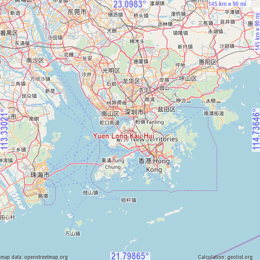
Yuen Long Kau Hui GPS coordinates[2]
22° 27' 0" North, 114° 1' 59.988" East
| Map corner | latitude | longitude |
|---|---|---|
| Upper-left | 23.0983°, | 113.33021° |
| Center: | 22.45°, | 114.03333° |
| Lower-right: | 21.79865°, | 114.73646° |
| Map W x H: | 144.5×144.5 km | = 89.8×89.8mi |
| max Lat: | 22.45007° ⇑6.2% North |
| Yuen Long Kau Hui: | 22.45° |
| min Lat: | ⇓93.8% South 22.20453° |
| min Long | Yuen Long Kau H | max Long |
| 113.86309° | 114.03333° | 114.26667° |
| W 25%⇐ | ⇒75% E |
Elevation
Elevation of Yuen Long Kau Hui is 4 m = 13 ft, and this is 68.2 m = 224 ft below average elevation for this country.
| Max E: |
435 m = 1427 ft | 93.7% |
| Avg. | 72.2 m = 237 ft | |
| Yuen Long Kau Hui | 4 m = 13 ft | |
Min E: |
1 m = 3 ft | 6.3% |
See also: Yuen Long Kau Hui elevation on elevation.city.
Geographical zone
Yuen Long Kau Hui is located in North Torrid zone (between Equator and Tropic of Cancer). Distance of this Northern Tropic circle is 109.7 km =68.2 mi to North.| Distance of | km | miles | from Yuen Long Kau Hui |
|---|---|---|---|
| North Pole | 7510.9 | 4667.1 | to North |
| Arctic Circle | 4905 | 3047.8 | to North |
| Tropic Cancer | 109.7 | 68.2 | to North |
| Equator | 2496.2 | 1551.1 | to South |


Nearby cities:
15 places around Yuen Long Kau Hui: (largest is in red/bold)
• Central
22.6 km =14 mi,  145°
145°
• Hong Kong
24 km =14.9 mi,  142°
142°
• Kowloon
21.4 km =13.3 mi,  133°
133°
• Ngong Ping
25.4 km =15.8 mi,  211°
211°
• Sai Kung
25.1 km =15.6 mi,  107°
107°
• Sha Tin
17.1 km =10.6 mi,  115°
115°
• Sham Shui Po
18.6 km =11.6 mi, 135°
• Tai O
27.9 km =17.3 mi,  218°
218°
• Tai Po
13.9 km =8.6 mi,  89°
89°
• Tsuen Wan
12 km =7.5 mi, 136°
• Tuen Mun
9.1 km =5.7 mi, 224°
• Tung Chung
20.3 km =12.6 mi, 207°
• Wan Chai
23.6 km =14.7 mi, 142°
• Wong Tai Sin
19 km =11.8 mi, 125°
• Yung Shue Wan
26.2 km =16.3 mi,  161°
161°
Sources, notices
• [Note1] Compared only with cities in Hong Kong existing in our database
• [Src1] Map data: © OpenStreetMap contributors (CC-BY-SA)
• [Src2] Other city data from geonames.org with taken over terms of usage.
• [Src3] Geographical zone / Annual Mean Temperature by Robert A. Rohde @ Wikipedia
