Severin geodata
Severin (Bjelovarsko-Bilogorska) is a populated place; located in Croatia in Europe/Zagreb (GMT+2) time zone. With population of 536 people, there are 834 cities with bigger population in this country. Compared to other cities in Croatia, 73.7% of cities are located further ↓South; 67.6% of cities are located further ←West and 52.3% of cities have higher elevation than Severin. Note1


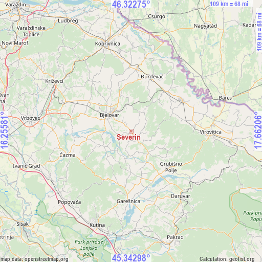
Severin GPS coordinates[2]
45° 50' 6.072" North, 16° 57' 32.148" East
| Map corner | latitude | longitude |
|---|---|---|
| Upper-left | 46.32275°, | 16.25581° |
| Center: | 45.83502°, | 16.95893° |
| Lower-right: | 45.34298°, | 17.66206° |
| Map W x H: | 108.9×108.9 km | = 67.7×67.7mi |
| max Lat: | 46.52694° ⇑26.3% North |
| Severin: | 45.83502° |
| min Lat: | ⇓73.7% South 42.54972° |
| min Long | Severin | max Long |
| 13.52389° | 16.95893° | 19.37694° |
| W 67.6%⇐ | ⇒32.4% E |
Elevation
Elevation of Severin is 123 m = 404 ft, and this is 30.3 m = 99 ft below average elevation for this country.
| Max E: |
827 m = 2713 ft | 52.3% |
| Avg. | 153.3 m = 503 ft | |
| Severin | 123 m = 404 ft | |
Min E: |
-1 m = -3 ft | 47.7% |
See also: Croatia elevation on elevation.city.
Geographical zone
Severin is located in North temperate zone (between Tropic of Cancer and the Arctic Circle). Distance of this North polar circle is 2304.8 km =1432.1 mi to North.| Distance of | km | miles | from Severin |
|---|---|---|---|
| North Pole | 4910.7 | 3051.4 | to North |
| Arctic Circle | 2304.8 | 1432.1 | to North |
| Tropic Cancer | 2490.5 | 1547.5 | to South |
| Equator | 5096.4 | 3166.8 | to South |


Nearby cities:
15 places around Severin: (largest is in red/bold)
• Bjelovar
11.1 km =6.9 mi,  309°
309°
• Brezovac
9.8 km =6.1 mi,  291°
291°
• Gornje Plavnice
13.1 km =8.1 mi,  326°
326°
• Ivanska
13 km =8.1 mi,  241°
241°
• Lasovac
5.8 km =3.6 mi,  71°
71°
• Nova Rača
4.3 km =2.7 mi,  185°
185°
• Novoseljani
7.9 km =4.9 mi, 312°
• Prespa
4.8 km =3 mi,  317°
317°
• Stare Plavnice
13.2 km =8.2 mi,  303°
303°
• Velika Pisanica
9.1 km =5.7 mi,  114°
114°
• Veliki Grđevac
11.7 km =7.3 mi,  143°
143°
• Veliko Korenovo
12.4 km =7.7 mi,  277°
277°
• Veliko Trojstvo
11.3 km =7 mi,  350°
350°
• Šandrovac
9.2 km =5.7 mi,  31°
31°
• Ždralovi
8 km =5 mi, 305°
Sources, notices
• [Note1] Compared only with cities in Croatia existing in our database
• [Src1] Map data: © OpenStreetMap contributors (CC-BY-SA)
• [Src2] Other city data from geonames.org with taken over terms of usage.
• [Src3] Geographical zone / Annual Mean Temperature by Robert A. Rohde @ Wikipedia
