Rasinja geodata
Rasinja (Koprivničko-Križevačka) is a seat of a second-order administrative division; located in Croatia in Europe/Zagreb (GMT+2) time zone. With population of 964 people, there are 476 cities with bigger population in this country. Compared to other cities in Croatia, 87.9% of cities are located further ↓South; 60.4% of cities are located further ←West and 65.7% of cities have lower elevation than Rasinja. Note1


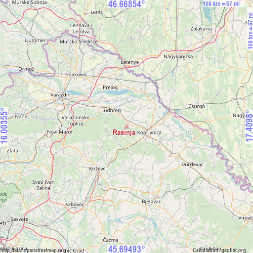
Rasinja GPS coordinates[2]
46° 11' 2.004" North, 16° 42' 24.012" East
| Map corner | latitude | longitude |
|---|---|---|
| Upper-left | 46.66854°, | 16.00355° |
| Center: | 46.18389°, | 16.70667° |
| Lower-right: | 45.69493°, | 17.4098° |
| Map W x H: | 108.3×108.3 km | = 67.3×67.3mi |
| max Lat: | 46.52694° ⇑12.1% North |
| Rasinja: | 46.18389° |
| min Lat: | ⇓87.9% South 42.54972° |
| min Long | Rasinja | max Long |
| 13.52389° | 16.70667° | 19.37694° |
| W 60.4%⇐ | ⇒39.6% E |
Elevation
Elevation of Rasinja is 156 m = 512 ft, and this is 2.7 m = 9 ft above average elevation for this country.
| Max E: |
827 m = 2713 ft | 34.3% |
| Rasinja | 156 m 512 ft | |
| Avg. | 153.3 m = 503 ft | |
Min E: |
-1 m = -3 ft | 65.7% |
See also: Croatia elevation on elevation.city.
Geographical zone
Rasinja is located in North temperate zone (between Tropic of Cancer and the Arctic Circle). Distance of this North polar circle is 2266 km =1408 mi to North.| Distance of | km | miles | from Rasinja |
|---|---|---|---|
| North Pole | 4871.9 | 3027.3 | to North |
| Arctic Circle | 2266 | 1408 | to North |
| Tropic Cancer | 2529.2 | 1571.6 | to South |
| Equator | 5135.2 | 3190.9 | to South |


Nearby cities:
15 places around Rasinja: (largest is in red/bold)
• Herešin
12.5 km =7.8 mi,  92°
92°
• Hrastovsko
11.9 km =7.4 mi,  307°
307°
• Karlovec Ludbreški
13.4 km =8.3 mi,  333°
333°
• Koprivnica
9.6 km =6 mi,  104°
104°
• Koprivnički Ivanec
8.7 km =5.4 mi,  76°
76°
• Ludbreg
10.4 km =6.5 mi,  316°
316°
• Mali Bukovec
11.3 km =7 mi,  12°
12°
• Reka
7.6 km =4.7 mi,  142°
142°
• Selnik
12 km =7.5 mi, 321°
• Sigetec Ludbreški
9.9 km =6.2 mi, 328°
• Slanje
13.6 km =8.5 mi,  292°
292°
• Sokolovac
8.1 km =5 mi,  180°
180°
• Subotica Podravska
3.3 km =2.1 mi, 91°
• Veliki Bukovec
12.3 km =7.6 mi,  2°
2°
• Vinogradi Ludbreški
11 km =6.8 mi,  300°
300°
Sources, notices
• [Note1] Compared only with cities in Croatia existing in our database
• [Src1] Map data: © OpenStreetMap contributors (CC-BY-SA)
• [Src2] Other city data from geonames.org with taken over terms of usage.
• [Src3] Geographical zone / Annual Mean Temperature by Robert A. Rohde @ Wikipedia
