Mala Subotica geodata
Mala Subotica (Međimurska) is a populated place; located in Croatia in Europe/Zagreb (GMT+2) time zone. With population of 1,986 people, there are 211 cities with bigger population in this country. Compared to other cities in Croatia, 96.7% of cities are located further ↓South; 52.8% of cities are located further ←West and 65% of cities have lower elevation than Mala Subotica. Note1


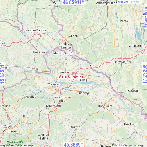
Mala Subotica GPS coordinates[2]
46° 22' 34.176" North, 16° 31' 44.148" East
| Map corner | latitude | longitude |
|---|---|---|
| Upper-left | 46.85911°, | 15.82581° |
| Center: | 46.37616°, | 16.52893° |
| Lower-right: | 45.8889°, | 17.23206° |
| Map W x H: | 107.9×107.9 km | = 67×67mi |
| max Lat: | 46.52694° ⇑3.3% North |
| Mala Subotica: | 46.37616° |
| min Lat: | ⇓96.7% South 42.54972° |
| min Long | Mala Subotica | max Long |
| 13.52389° | 16.52893° | 19.37694° |
| W 52.8%⇐ | ⇒47.2% E |
Elevation
Elevation of Mala Subotica is 154 m = 505 ft, and this is 0.69999999999999 m = 2 ft above average elevation for this country.
| Max E: |
827 m = 2713 ft | 35% |
| Mala Subotica | 154 m 505 ft | |
| Avg. | 153.3 m = 503 ft | |
Min E: |
-1 m = -3 ft | 65% |
See also: Croatia elevation on elevation.city.
Geographical zone
Mala Subotica is located in North temperate zone (between Tropic of Cancer and the Arctic Circle). Distance of this North polar circle is 2244.6 km =1394.7 mi to North.| Distance of | km | miles | from Mala Subotica |
|---|---|---|---|
| North Pole | 4850.5 | 3014 | to North |
| Arctic Circle | 2244.6 | 1394.7 | to North |
| Tropic Cancer | 2550.6 | 1584.9 | to South |
| Equator | 5156.5 | 3204.1 | to South |


Nearby cities:
15 places around Mala Subotica: (largest is in red/bold)
• Belica
3.2 km =2 mi,  345°
345°
• Gardinovec
6.1 km =3.8 mi,  21°
21°
• Ivanovec
4.1 km =2.5 mi,  257°
257°
• Mihovljan
7.2 km =4.5 mi,  300°
300°
• Novo Selo Rok
7.7 km =4.8 mi,  318°
318°
• Orehovica
5.2 km =3.2 mi,  198°
198°
• Palinovec
5.6 km =3.5 mi,  65°
65°
• Palovec
2 km =1.2 mi,  45°
45°
• Podbrest
5.1 km =3.2 mi,  166°
166°
• Pribislavec
4 km =2.5 mi, 297°
• Totovec
7.8 km =4.8 mi,  238°
238°
• Turčišće
6.8 km =4.2 mi, 49°
• Čakovec
7.3 km =4.5 mi,  277°
277°
• Čehovec
7.1 km =4.4 mi,  100°
100°
• Štefanec
2.7 km =1.7 mi,  250°
250°
Sources, notices
• [Note1] Compared only with cities in Croatia existing in our database
• [Src1] Map data: © OpenStreetMap contributors (CC-BY-SA)
• [Src2] Other city data from geonames.org with taken over terms of usage.
• [Src3] Geographical zone / Annual Mean Temperature by Robert A. Rohde @ Wikipedia
