Kotoriba geodata
Kotoriba (Međimurska) is a seat of a second-order administrative division; located in Croatia in Europe/Zagreb (GMT+2) time zone. With population of 3,349 people, there are 120 cities with bigger population in this country. Compared to other cities in Croatia, 95.7% of cities are located further ↓South; 63.6% of cities are located further ←West and 54.3% of cities have lower elevation than Kotoriba. Note1


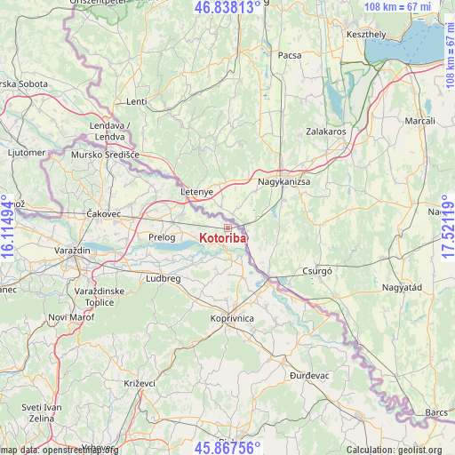
Kotoriba GPS coordinates[2]
46° 21' 18" North, 16° 49' 5.016" East
| Map corner | latitude | longitude |
|---|---|---|
| Upper-left | 46.83813°, | 16.11494° |
| Center: | 46.355°, | 16.81806° |
| Lower-right: | 45.86756°, | 17.52119° |
| Map W x H: | 107.9×107.9 km | = 67×67mi |
| max Lat: | 46.52694° ⇑4.3% North |
| Kotoriba: | 46.355° |
| min Lat: | ⇓95.7% South 42.54972° |
| min Long | Kotoriba | max Long |
| 13.52389° | 16.81806° | 19.37694° |
| W 63.6%⇐ | ⇒36.4% E |
Elevation
Elevation of Kotoriba is 134 m = 440 ft, and this is 19.3 m = 63 ft below average elevation for this country.
| Max E: |
827 m = 2713 ft | 45.7% |
| Avg. | 153.3 m = 503 ft | |
| Kotoriba | 134 m = 440 ft | |
Min E: |
-1 m = -3 ft | 54.3% |
See also: Croatia elevation on elevation.city.
Geographical zone
Kotoriba is located in North temperate zone (between Tropic of Cancer and the Arctic Circle). Distance of this North polar circle is 2247 km =1396.2 mi to North.| Distance of | km | miles | from Kotoriba |
|---|---|---|---|
| North Pole | 4852.9 | 3015.5 | to North |
| Arctic Circle | 2247 | 1396.2 | to North |
| Tropic Cancer | 2548.3 | 1583.4 | to South |
| Equator | 5154.2 | 3202.7 | to South |


Nearby cities:
15 places around Kotoriba: (largest is in red/bold)
• Cirkovljan
13 km =8.1 mi,  264°
264°
• Donja Dubrava
4.5 km =2.8 mi,  185°
185°
• Donji Kraljevec
12.7 km =7.9 mi,  275°
275°
• Donji Mihaljevec
8.3 km =5.2 mi,  254°
254°
• Donji Vidovec
3.7 km =2.3 mi,  219°
219°
• Draškovec
10.9 km =6.8 mi,  267°
267°
• Goričan
11 km =6.8 mi,  287°
287°
• Hodošan
14.1 km =8.8 mi, 288°
• Legrad
7 km =4.3 mi,  155°
155°
• Mali Bukovec
10 km =6.2 mi, 217°
• Sveta Marija
6.2 km =3.9 mi, 249°
• Torčec
15.5 km =9.6 mi, 160°
• Veliki Bukovec
10.5 km =6.5 mi,  230°
230°
• Ðelekovec
12.4 km =7.7 mi, 162°
• Čehovec
15.2 km =9.4 mi, 274°
Sources, notices
• [Note1] Compared only with cities in Croatia existing in our database
• [Src1] Map data: © OpenStreetMap contributors (CC-BY-SA)
• [Src2] Other city data from geonames.org with taken over terms of usage.
• [Src3] Geographical zone / Annual Mean Temperature by Robert A. Rohde @ Wikipedia
