Torčec geodata
Torčec (Koprivničko-Križevačka) is a populated place; located in Croatia in Europe/Zagreb (GMT+2) time zone. With population of 621 people, there are 733 cities with bigger population in this country. Compared to other cities in Croatia, 89.4% of cities are located further ↓South; 65.1% of cities are located further ←West and 50.5% of cities have lower elevation than Torčec. Note1


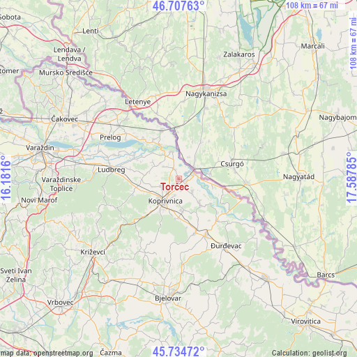
Torčec GPS coordinates[2]
46° 13' 23.988" North, 16° 53' 4.992" East
| Map corner | latitude | longitude |
|---|---|---|
| Upper-left | 46.70763°, | 16.1816° |
| Center: | 46.22333°, | 16.88472° |
| Lower-right: | 45.73472°, | 17.58785° |
| Map W x H: | 108.2×108.2 km | = 67.2×67.2mi |
| max Lat: | 46.52694° ⇑10.6% North |
| Torčec: | 46.22333° |
| min Lat: | ⇓89.4% South 42.54972° |
| min Long | Torčec | max Long |
| 13.52389° | 16.88472° | 19.37694° |
| W 65.1%⇐ | ⇒34.9% E |
Elevation
Elevation of Torčec is 128 m = 420 ft, and this is 25.3 m = 83 ft below average elevation for this country.
| Max E: |
827 m = 2713 ft | 49.5% |
| Avg. | 153.3 m = 503 ft | |
| Torčec | 128 m = 420 ft | |
Min E: |
-1 m = -3 ft | 50.5% |
See also: Croatia elevation on elevation.city.
Geographical zone
Torčec is located in North temperate zone (between Tropic of Cancer and the Arctic Circle). Distance of this North polar circle is 2261.6 km =1405.3 mi to North.| Distance of | km | miles | from Torčec |
|---|---|---|---|
| North Pole | 4867.5 | 3024.5 | to North |
| Arctic Circle | 2261.6 | 1405.3 | to North |
| Tropic Cancer | 2533.6 | 1574.3 | to South |
| Equator | 5139.6 | 3193.6 | to South |


Nearby cities:
15 places around Torčec: (largest is in red/bold)
• Donja Dubrava
11.6 km =7.2 mi,  331°
331°
• Drnje
3.1 km =1.9 mi,  126°
126°
• Glogovac
12 km =7.5 mi,  183°
183°
• Gola
13.7 km =8.5 mi,  102°
102°
• Herešin
5 km =3.1 mi,  194°
194°
• Hlebine
9.5 km =5.9 mi,  140°
140°
• Koprivnica
8 km =5 mi,  213°
213°
• Koprivnički Bregi
9.6 km =6 mi,  170°
170°
• Koprivnički Ivanec
5.7 km =3.5 mi,  246°
246°
• Legrad
8.5 km =5.3 mi,  345°
345°
• Mali Bukovec
13 km =8.1 mi,  300°
300°
• Peteranec
3.5 km =2.2 mi, 171°
• Sigetec
5.5 km =3.4 mi, 134°
• Subotica Podravska
11.3 km =7 mi, 246°
• Ðelekovec
3.1 km =1.9 mi, 333°
Sources, notices
• [Note1] Compared only with cities in Croatia existing in our database
• [Src1] Map data: © OpenStreetMap contributors (CC-BY-SA)
• [Src2] Other city data from geonames.org with taken over terms of usage.
• [Src3] Geographical zone / Annual Mean Temperature by Robert A. Rohde @ Wikipedia
