Kistanje geodata
Kistanje (Šibensko-Kniniska) is a seat of a second-order administrative division; located in Croatia in Europe/Zagreb (GMT+2) time zone. With population of 1,761 people, there are 248 cities with bigger population in this country. Compared to other cities in Croatia, 84.2% of cities are located further ↑North; 70% of cities are located further →East and 85.4% of cities have lower elevation than Kistanje. Note1


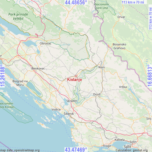
Kistanje GPS coordinates[2]
43° 58' 58.008" North, 15° 57' 54" East
| Map corner | latitude | longitude |
|---|---|---|
| Upper-left | 44.48656°, | 15.26188° |
| Center: | 43.98278°, | 15.965° |
| Lower-right: | 43.47469°, | 16.66813° |
| Map W x H: | 112.5×112.5 km | = 69.9×69.9mi |
| max Lat: | 46.52694° ⇑84.2% North |
| Kistanje: | 43.98278° |
| min Lat: | ⇓15.8% South 42.54972° |
| min Long | Kistanje | max Long |
| 13.52389° | 15.965° | 19.37694° |
| W 30%⇐ | ⇒70% E |
Elevation
Elevation of Kistanje is 239 m = 784 ft, and this is 85.7 m = 281 ft above average elevation for this country.
| Max E: |
827 m = 2713 ft | 14.6% |
| Kistanje | 239 m 784 ft | |
| Avg. | 153.3 m = 503 ft | |
Min E: |
-1 m = -3 ft | 85.4% |
See also: Croatia elevation on elevation.city.
Geographical zone
Kistanje is located in North temperate zone (between Tropic of Cancer and the Arctic Circle). Distance of this Northern Tropic circle is 2284.5 km =1419.5 mi to South.| Distance of | km | miles | from Kistanje |
|---|---|---|---|
| North Pole | 5116.6 | 3179.3 | to North |
| Arctic Circle | 2510.7 | 1560.1 | to North |
| Tropic Cancer | 2284.5 | 1419.5 | to South |
| Equator | 4890.4 | 3038.8 | to South |


Nearby cities:
15 places around Kistanje: (largest is in red/bold)
• Bilice
22.8 km =14.2 mi,  198°
198°
• Biskupija
22 km =13.7 mi,  81°
81°
• Drniš
20.3 km =12.6 mi,  131°
131°
• Dubravice
14.6 km =9.1 mi,  188°
188°
• Ervenik
13.1 km =8.1 mi,  353°
353°
• Knin
19.6 km =12.2 mi,  70°
70°
• Kninsko Polje
21.1 km =13.1 mi, 68°
• Kovačić
21.9 km =13.6 mi, 70°
• Lišane Ostrovičke
15.4 km =9.6 mi,  264°
264°
• Oklaj
10 km =6.2 mi,  110°
110°
• Raslina
21.5 km =13.4 mi, 204°
• Skradin
18.4 km =11.4 mi, 190°
• Stankovci
22.7 km =14.1 mi,  249°
249°
• Vukšić
19.7 km =12.2 mi, 257°
• Žagrović
18.6 km =11.6 mi,  60°
60°
Sources, notices
• [Note1] Compared only with cities in Croatia existing in our database
• [Src1] Map data: © OpenStreetMap contributors (CC-BY-SA)
• [Src2] Other city data from geonames.org with taken over terms of usage.
• [Src3] Geographical zone / Annual Mean Temperature by Robert A. Rohde @ Wikipedia
