Gornja Greda geodata
Gornja Greda (Zagrebačka) is a populated place; located in Croatia in Europe/Zagreb (GMT+2) time zone. With population of 625 people, there are 728 cities with bigger population in this country. Compared to other cities in Croatia, 72.7% of cities are located further ↓South; 56.9% of cities are located further →East and 64.4% of cities have higher elevation than Gornja Greda. Note1


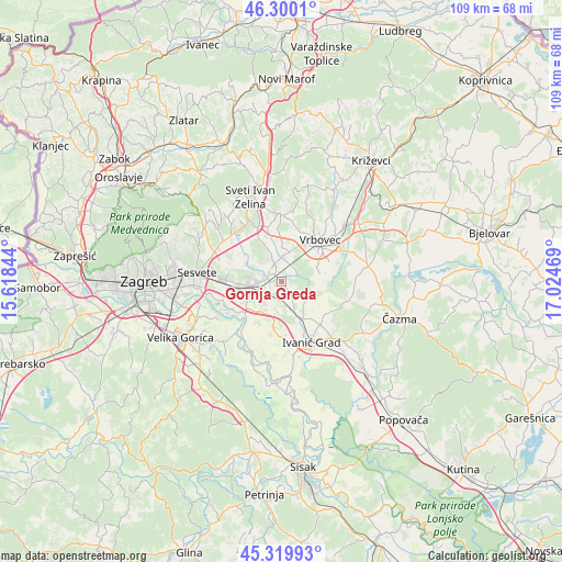
Gornja Greda GPS coordinates[2]
45° 48' 43.812" North, 16° 19' 17.616" East
| Map corner | latitude | longitude |
|---|---|---|
| Upper-left | 46.3001°, | 15.61844° |
| Center: | 45.81217°, | 16.32156° |
| Lower-right: | 45.31993°, | 17.02469° |
| Map W x H: | 109×109 km | = 67.7×67.7mi |
| max Lat: | 46.52694° ⇑27.3% North |
| Gornja Greda: | 45.81217° |
| min Lat: | ⇓72.7% South 42.54972° |
| min Long | Gornja Greda | max Long |
| 13.52389° | 16.32156° | 19.37694° |
| W 43.1%⇐ | ⇒56.9% E |
Elevation
Elevation of Gornja Greda is 103 m = 338 ft, and this is 50.3 m = 165 ft below average elevation for this country.
| Max E: |
827 m = 2713 ft | 64.4% |
| Avg. | 153.3 m = 503 ft | |
| Gornja Greda | 103 m = 338 ft | |
Min E: |
-1 m = -3 ft | 35.6% |
See also: Croatia elevation on elevation.city.
Geographical zone
Gornja Greda is located in North temperate zone (between Tropic of Cancer and the Arctic Circle). Distance of this North polar circle is 2307.3 km =1433.7 mi to North.| Distance of | km | miles | from Gornja Greda |
|---|---|---|---|
| North Pole | 4913.2 | 3052.9 | to North |
| Arctic Circle | 2307.3 | 1433.7 | to North |
| Tropic Cancer | 2487.9 | 1545.9 | to South |
| Equator | 5093.8 | 3165.1 | to South |


Nearby cities:
15 places around Gornja Greda: (largest is in red/bold)
• Brckovljani
2.9 km =1.8 mi,  324°
324°
• Brčevec
9.5 km =5.9 mi,  50°
50°
• Dugo Selo
6 km =3.7 mi,  263°
263°
• Gračec
2.4 km =1.5 mi,  350°
350°
• Jalševec Nartski
10.7 km =6.6 mi,  240°
240°
• Kloštar Ivanić
11.3 km =7 mi,  135°
135°
• Lonjica
4.8 km =3 mi,  7°
7°
• Lupoglav
2.6 km =1.6 mi,  132°
132°
• Prikraj
1.6 km =1 mi,  340°
340°
• Puhovo
6 km =3.7 mi,  246°
246°
• Rugvica
10.9 km =6.8 mi,  219°
219°
• Stančić
5.1 km =3.2 mi, 324°
• Struga Nartska
11.3 km =7 mi, 241°
• Velika Ostrna
4.1 km =2.5 mi,  228°
228°
• Vrbovec
11.1 km =6.9 mi,  44°
44°
Sources, notices
• [Note1] Compared only with cities in Croatia existing in our database
• [Src1] Map data: © OpenStreetMap contributors (CC-BY-SA)
• [Src2] Other city data from geonames.org with taken over terms of usage.
• [Src3] Geographical zone / Annual Mean Temperature by Robert A. Rohde @ Wikipedia
