Domagović geodata
Domagović (Zagrebačka) is a populated place; located in Croatia in Europe/Zagreb (GMT+2) time zone. With population of 541 people, there are 827 cities with bigger population in this country. Compared to other cities in Croatia, 60.3% of cities are located further ↓South; 80.8% of cities are located further →East and 56.3% of cities have higher elevation than Domagović. Note1


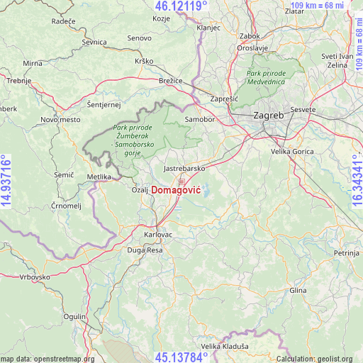
Domagović GPS coordinates[2]
45° 37' 54.012" North, 15° 38' 25.008" East
| Map corner | latitude | longitude |
|---|---|---|
| Upper-left | 46.12119°, | 14.93716° |
| Center: | 45.63167°, | 15.64028° |
| Lower-right: | 45.13784°, | 16.34341° |
| Map W x H: | 109.3×109.3 km | = 67.9×67.9mi |
| max Lat: | 46.52694° ⇑39.7% North |
| Domagović: | 45.63167° |
| min Lat: | ⇓60.3% South 42.54972° |
| min Long | Domagović | max Long |
| 13.52389° | 15.64028° | 19.37694° |
| W 19.2%⇐ | ⇒80.8% E |
Elevation
Elevation of Domagović is 114 m = 374 ft, and this is 39.3 m = 129 ft below average elevation for this country.
| Max E: |
827 m = 2713 ft | 56.3% |
| Avg. | 153.3 m = 503 ft | |
| Domagović | 114 m = 374 ft | |
Min E: |
-1 m = -3 ft | 43.7% |
See also: Croatia elevation on elevation.city.
Geographical zone
Domagović is located in North temperate zone (between Tropic of Cancer and the Arctic Circle). Distance of this North polar circle is 2327.4 km =1446.2 mi to North.| Distance of | km | miles | from Domagović |
|---|---|---|---|
| North Pole | 4933.3 | 3065.4 | to North |
| Arctic Circle | 2327.4 | 1446.2 | to North |
| Tropic Cancer | 2467.8 | 1533.4 | to South |
| Equator | 5073.8 | 3152.7 | to South |


Nearby cities:
15 places around Domagović: (largest is in red/bold)
• Bratina
14.6 km =9.1 mi,  94°
94°
• Cvetković
2.4 km =1.5 mi,  22°
22°
• Donja Zdenčina
10.6 km =6.6 mi,  68°
68°
• Donji Desinec
7.7 km =4.8 mi,  43°
43°
• Draganići
4.7 km =2.9 mi,  221°
221°
• Galgovo
14.2 km =8.8 mi, 37°
• Gornji Desinec
7.9 km =4.9 mi,  30°
30°
• Jastrebarsko
4.1 km =2.5 mi,  9°
9°
• Klinča Sela
10.2 km =6.3 mi,  50°
50°
• Krašić
9.9 km =6.2 mi,  285°
285°
• Kupinec
11.8 km =7.3 mi,  75°
75°
• Ozalj
14.1 km =8.8 mi,  258°
258°
• Pavučnjak
13.1 km =8.1 mi, 46°
• Rečica
13.4 km =8.3 mi,  172°
172°
• Vodostaj
14.8 km =9.2 mi,  198°
198°
Sources, notices
• [Note1] Compared only with cities in Croatia existing in our database
• [Src1] Map data: © OpenStreetMap contributors (CC-BY-SA)
• [Src2] Other city data from geonames.org with taken over terms of usage.
• [Src3] Geographical zone / Annual Mean Temperature by Robert A. Rohde @ Wikipedia
