Podgora geodata
Podgora (Dubrovačko-Neretvanska) is a populated locality; located in Croatia in Europe/Zagreb (GMT+2) time zone. With population of 1,541 people, there are 288 cities with bigger population in this country. Compared to other cities in Croatia, 98.3% of cities are located further ↑North; 80% of cities are located further ←West and 86.6% of cities have lower elevation than Podgora. Note1


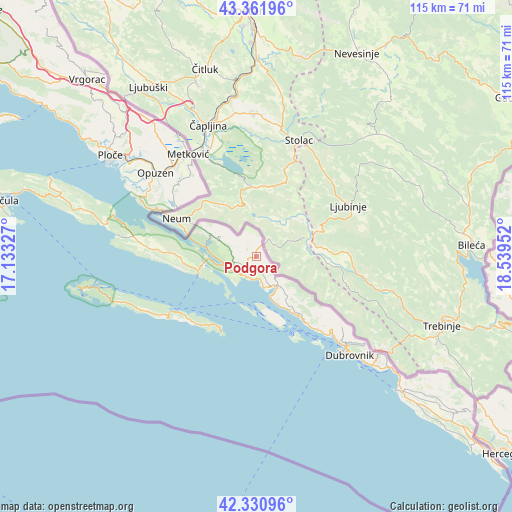
Podgora GPS coordinates[2]
42° 50' 54.996" North, 17° 50' 11.004" East
| Map corner | latitude | longitude |
|---|---|---|
| Upper-left | 43.36196°, | 17.13327° |
| Center: | 42.84861°, | 17.83639° |
| Lower-right: | 42.33096°, | 18.53952° |
| Map W x H: | 114.6×114.6 km | = 71.2×71.2mi |
| max Lat: | 46.52694° ⇑98.3% North |
| Podgora: | 42.84861° |
| min Lat: | ⇓1.7% South 42.54972° |
| min Long | Podgora | max Long |
| 13.52389° | 17.83639° | 19.37694° |
| W 80%⇐ | ⇒20% E |
Elevation
Elevation of Podgora is 249 m = 817 ft, and this is 95.7 m = 314 ft above average elevation for this country.
| Max E: |
827 m = 2713 ft | 13.4% |
| Podgora | 249 m 817 ft | |
| Avg. | 153.3 m = 503 ft | |
Min E: |
-1 m = -3 ft | 86.6% |
See also: Croatia elevation on elevation.city.
Geographical zone
Podgora is located in North temperate zone (between Tropic of Cancer and the Arctic Circle). Distance of this Northern Tropic circle is 2158.4 km =1341.2 mi to South.| Distance of | km | miles | from Podgora |
|---|---|---|---|
| North Pole | 5242.7 | 3257.7 | to North |
| Arctic Circle | 2636.9 | 1638.5 | to North |
| Tropic Cancer | 2158.4 | 1341.2 | to South |
| Equator | 4764.3 | 2960.4 | to South |


Nearby cities:
15 places around Podgora: (largest is in red/bold)
• Babino Polje
25.8 km =16 mi,  240°
240°
• Blato
30.4 km =18.9 mi,  251°
251°
• Dubrovnik
30.6 km =19 mi,  136°
136°
• Komin
32.4 km =20.1 mi,  311°
311°
• Krvavac
28.2 km =17.5 mi, 313°
• Kula Norinska
27.7 km =17.2 mi,  317°
317°
• Metković
27.5 km =17.1 mi,  326°
326°
• Mokošica
28.3 km =17.6 mi,  132°
132°
• Opuzen
28.8 km =17.9 mi, 310°
• Orašac
21.5 km =13.4 mi, 139°
• Slano
8.3 km =5.2 mi,  146°
146°
• Ston
11.5 km =7.1 mi,  264°
264°
• Vlaka
30.4 km =18.9 mi,  303°
303°
• Zaton
24.1 km =15 mi, 136°
• Zaton Doli
7.2 km =4.5 mi, 256°
Sources, notices
• [Note1] Compared only with cities in Croatia existing in our database
• [Src1] Map data: © OpenStreetMap contributors (CC-BY-SA)
• [Src2] Other city data from geonames.org with taken over terms of usage.
• [Src3] Geographical zone / Annual Mean Temperature by Robert A. Rohde @ Wikipedia
