Rejoyoso geodata
Rejoyoso (East Java) is a seat of a fourth-order administrative division; located in Indonesia in Asia/Jakarta (GMT+7) time zone. In our database, there are 407 cities with bigger population. Compared to other cities in Indonesia, 72.6% of cities are located further ↑North; 55.8% of cities are located further ←West and 71.4% of cities have lower elevation than Rejoyoso. Note1


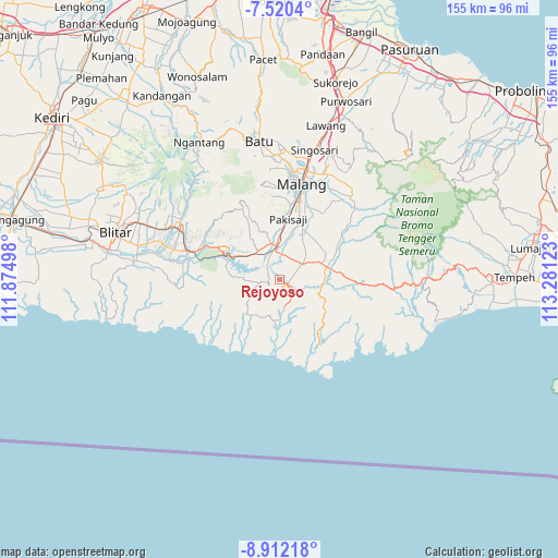
Rejoyoso GPS coordinates[2]
8° 13' 0.84" South, 112° 34' 41.16" East
| Map corner | latitude | longitude |
|---|---|---|
| Upper-left | -7.5204°, | 111.87498° |
| Center: | -8.2169°, | 112.5781° |
| Lower-right: | -8.91218°, | 113.28123° |
| Map W x H: | 154.8×154.8 km | = 96.2×96.2mi |
| max Lat: | 5.88969° ⇑72.6% North |
| Rejoyoso: | -8.2169° |
| min Lat: | ⇓27.4% South -10.934° |
| min Long | Rejoyoso | max Long |
| 95.1345° | 112.5781° | 140.9419° |
| W 55.8%⇐ | ⇒44.2% E |
Elevation
Elevation of Rejoyoso is 311 m = 1020 ft, and this is 81.3 m = 267 ft above average elevation for this country.
| Max E: |
3185 m = 10449 ft | 28.6% |
| Rejoyoso | 311 m 1020 ft | |
| Avg. | 229.7 m = 754 ft | |
Min E: |
-1 m = -3 ft | 71.4% |
See also: Indonesia elevation on elevation.city.
Geographical zone
Rejoyoso is located in South Torrid zone (between Equator and Tropic of Capricorn). Distance of Equator is 913.6 km =567.7 mi to North.| Distance of | km | miles | from Rejoyoso |
|---|---|---|---|
| Equator | 913.6 | 567.7 | to North |
| Tropic Capricorn | 1692.3 | 1051.5 | to South |
| Antarctic Circle | 6487.5 | 4031.1 | to South |
| South Pole | 9093.4 | 5650.4 | to South |


Nearby cities:
15 places around Rejoyoso: (largest is in red/bold)
• Balearjo
2.4 km =1.5 mi,  351°
351°
• Banjarejokrajan
6.4 km =4 mi,  53°
53°
• Brongkal
4.4 km =2.7 mi,  23°
23°
• Kademangan
2.3 km =1.4 mi,  83°
83°
• Kanigorokrajan
3.5 km =2.2 mi,  1°
1°
• Karangsuko
6.1 km =3.8 mi, 22°
• Pagak
5.6 km =3.5 mi,  259°
259°
• Pagelaran
5.1 km =3.2 mi,  65°
65°
• Segaran
6.4 km =4 mi,  115°
115°
• Sengguruhkrajan
5.8 km =3.6 mi,  327°
327°
• Sukosarikrajan
6.7 km =4.2 mi, 21°
• Sumberrojokrajan
5.8 km =3.6 mi, 121°
• Sumuran
2.7 km =1.7 mi,  285°
285°
• Suwaru
3.4 km =2.1 mi, 81°
• Tegalsari
5.8 km =3.6 mi,  358°
358°
Sources, notices
• [Note1] Compared only with cities in Indonesia existing in our database
• [Src1] Map data: © OpenStreetMap contributors (CC-BY-SA)
• [Src2] Other city data from geonames.org with taken over terms of usage.
• [Src3] Geographical zone / Annual Mean Temperature by Robert A. Rohde @ Wikipedia
