Jatirejo geodata
Jatirejo (East Java) is a seat of a fourth-order administrative division; located in Indonesia in Asia/Jakarta (GMT+7) time zone. In our database, there are 407 cities with bigger population. Compared to other cities in Indonesia, 70.6% of cities are located further ↑North; 51.8% of cities are located further →East and 74.4% of cities have lower elevation than Jatirejo. Note1


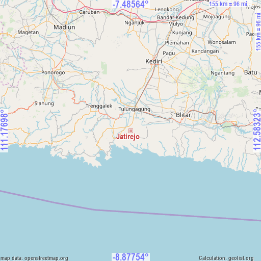
Jatirejo GPS coordinates[2]
8° 10' 55.92" South, 111° 52' 48.36" East
| Map corner | latitude | longitude |
|---|---|---|
| Upper-left | -7.48564°, | 111.17698° |
| Center: | -8.1822°, | 111.8801° |
| Lower-right: | -8.87754°, | 112.58323° |
| Map W x H: | 154.8×154.8 km | = 96.2×96.2mi |
| max Lat: | 5.88969° ⇑70.6% North |
| Jatirejo: | -8.1822° |
| min Lat: | ⇓29.4% South -10.934° |
| min Long | Jatirejo | max Long |
| 95.1345° | 111.8801° | 140.9419° |
| W 48.2%⇐ | ⇒51.8% E |
Elevation
Elevation of Jatirejo is 351 m = 1152 ft, and this is 121.3 m = 398 ft above average elevation for this country.
| Max E: |
3185 m = 10449 ft | 25.6% |
| Jatirejo | 351 m 1152 ft | |
| Avg. | 229.7 m = 754 ft | |
Min E: |
-1 m = -3 ft | 74.4% |
See also: Indonesia elevation on elevation.city.
Geographical zone
Jatirejo is located in South Torrid zone (between Equator and Tropic of Capricorn). Distance of Equator is 909.8 km =565.3 mi to North.| Distance of | km | miles | from Jatirejo |
|---|---|---|---|
| Equator | 909.8 | 565.3 | to North |
| Tropic Capricorn | 1696.1 | 1053.9 | to South |
| Antarctic Circle | 6491.4 | 4033.6 | to South |
| South Pole | 9097.3 | 5652.8 | to South |


Nearby cities:
15 places around Jatirejo: (largest is in red/bold)
• Bangus Kulon
4.8 km =3 mi,  334°
334°
• Campurdarat
3.5 km =2.2 mi,  302°
302°
• Campurjanggang
3.3 km =2.1 mi,  312°
312°
• Cerme Kidul
4.3 km =2.7 mi,  272°
272°
• Gendingan
4.8 km =3 mi,  281°
281°
• Krajan
5 km =3.1 mi,  174°
174°
• Krenggan
5 km =3.1 mi,  291°
291°
• Ngayem
1.7 km =1.1 mi,  206°
206°
• Ngepoh Kidul
3.3 km =2.1 mi, 205°
• Pagersari
5.3 km =3.3 mi,  65°
65°
• Pelem
2.7 km =1.7 mi,  3°
3°
• Pojok
4.7 km =2.9 mi,  17°
17°
• Sawo
5.5 km =3.4 mi,  246°
246°
• Tanggunggunung
4.1 km =2.5 mi,  186°
186°
• Tumpakjoho
3.7 km =2.3 mi,  97°
97°
Sources, notices
• [Note1] Compared only with cities in Indonesia existing in our database
• [Src1] Map data: © OpenStreetMap contributors (CC-BY-SA)
• [Src2] Other city data from geonames.org with taken over terms of usage.
• [Src3] Geographical zone / Annual Mean Temperature by Robert A. Rohde @ Wikipedia
