Ngeper geodata
Ngeper (East Java) is a seat of a fourth-order administrative division; located in Indonesia in Asia/Jakarta (GMT+7) time zone. In our database, there are 407 cities with bigger population. Compared to other cities in Indonesia, 55.4% of cities are located further ↓South; 56.2% of cities are located further →East and 61.3% of cities have higher elevation than Ngeper. Note1


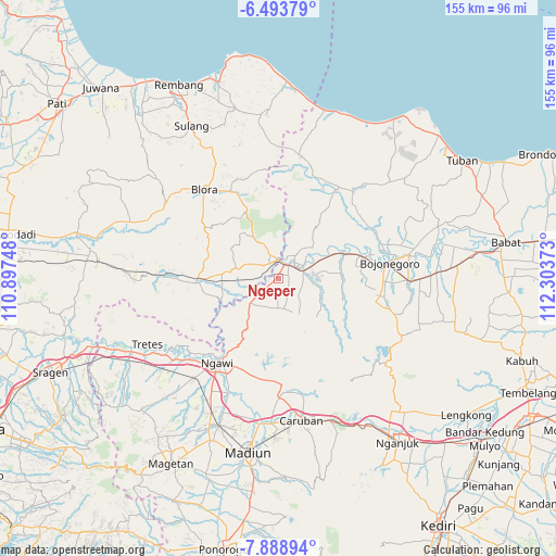
Ngeper GPS coordinates[2]
7° 11' 30.84" South, 111° 36' 2.16" East
| Map corner | latitude | longitude |
|---|---|---|
| Upper-left | -6.49379°, | 110.89748° |
| Center: | -7.1919°, | 111.6006° |
| Lower-right: | -7.88894°, | 112.30373° |
| Map W x H: | 155.1×155.1 km | = 96.4×96.4mi |
| max Lat: | 5.88969° ⇑44.6% North |
| Ngeper: | -7.1919° |
| min Lat: | ⇓55.4% South -10.934° |
| min Long | Ngeper | max Long |
| 95.1345° | 111.6006° | 140.9419° |
| W 43.8%⇐ | ⇒56.2% E |
Elevation
Elevation of Ngeper is 54 m = 177 ft, and this is 175.7 m = 576 ft below average elevation for this country.
| Max E: |
3185 m = 10449 ft | 61.3% |
| Avg. | 229.7 m = 754 ft | |
| Ngeper | 54 m = 177 ft | |
Min E: |
-1 m = -3 ft | 38.7% |
See also: Indonesia elevation on elevation.city.
Geographical zone
Ngeper is located in South Torrid zone (between Equator and Tropic of Capricorn). Distance of Equator is 799.7 km =496.9 mi to North.| Distance of | km | miles | from Ngeper |
|---|---|---|---|
| Equator | 799.7 | 496.9 | to North |
| Tropic Capricorn | 1806.3 | 1122.4 | to South |
| Antarctic Circle | 6601.5 | 4102 | to South |
| South Pole | 9207.4 | 5721.2 | to South |


Nearby cities:
15 places around Ngeper: (largest is in red/bold)
• Blimbing
0.8 km =0.5 mi,  359°
359°
• Donan
4.4 km =2.7 mi,  111°
111°
• Gempol
1.8 km =1.1 mi,  54°
54°
• Ketawang
4 km =2.5 mi,  43°
43°
• Klempun
4.5 km =2.8 mi,  204°
204°
• Kuncen
4.5 km =2.8 mi,  30°
30°
• Mersodo
1.9 km =1.2 mi,  318°
318°
• Nglanjuk
3.3 km =2.1 mi,  328°
328°
• Nguken
3.5 km =2.2 mi,  350°
350°
• Padangan
4.5 km =2.8 mi,  19°
19°
• Pengkok
3 km =1.9 mi, 20°
• Prangi
2 km =1.2 mi,  284°
284°
• Sonorejo
2.8 km =1.7 mi,  65°
65°
• Sumberpitu
2.2 km =1.4 mi,  290°
290°
• Tebon
3.8 km =2.4 mi, 276°
Sources, notices
• [Note1] Compared only with cities in Indonesia existing in our database
• [Src1] Map data: © OpenStreetMap contributors (CC-BY-SA)
• [Src2] Other city data from geonames.org with taken over terms of usage.
• [Src3] Geographical zone / Annual Mean Temperature by Robert A. Rohde @ Wikipedia
