Donan geodata
Donan (East Java) is a seat of a fourth-order administrative division; located in Indonesia in Asia/Jakarta (GMT+7) time zone. In our database, there are 407 cities with bigger population. Compared to other cities in Indonesia, 54.7% of cities are located further ↓South; 55.6% of cities are located further →East and 58.4% of cities have higher elevation than Donan. Note1


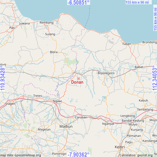
Donan GPS coordinates[2]
7° 12' 23.76" South, 111° 38' 14.64" East
| Map corner | latitude | longitude |
|---|---|---|
| Upper-left | -6.50851°, | 110.93428° |
| Center: | -7.2066°, | 111.6374° |
| Lower-right: | -7.90362°, | 112.34053° |
| Map W x H: | 155.1×155.1 km | = 96.4×96.4mi |
| max Lat: | 5.88969° ⇑45.3% North |
| Donan: | -7.2066° |
| min Lat: | ⇓54.7% South -10.934° |
| min Long | Donan | max Long |
| 95.1345° | 111.6374° | 140.9419° |
| W 44.4%⇐ | ⇒55.6% E |
Elevation
Elevation of Donan is 66 m = 217 ft, and this is 163.7 m = 537 ft below average elevation for this country.
| Max E: |
3185 m = 10449 ft | 58.4% |
| Avg. | 229.7 m = 754 ft | |
| Donan | 66 m = 217 ft | |
Min E: |
-1 m = -3 ft | 41.6% |
See also: Indonesia elevation on elevation.city.
Geographical zone
Donan is located in South Torrid zone (between Equator and Tropic of Capricorn). Distance of Equator is 801.3 km =497.9 mi to North.| Distance of | km | miles | from Donan |
|---|---|---|---|
| Equator | 801.3 | 497.9 | to North |
| Tropic Capricorn | 1804.6 | 1121.3 | to South |
| Antarctic Circle | 6599.9 | 4101 | to South |
| South Pole | 9205.8 | 5720.2 | to South |


Nearby cities:
15 places around Donan: (largest is in red/bold)
• Banjarjo
5.5 km =3.4 mi,  348°
348°
• Beged
5 km =3.1 mi,  44°
44°
• Blimbing
4.8 km =3 mi,  301°
301°
• Bonorejo
5.3 km =3.3 mi,  60°
60°
• Dukuh Lor
5.5 km =3.4 mi,  27°
27°
• Gapluk
2.7 km =1.7 mi,  85°
85°
• Gempol
3.7 km =2.3 mi,  315°
315°
• Ketawang
4.7 km =2.9 mi,  344°
344°
• Ngeper
4.4 km =2.7 mi,  291°
291°
• Pengkok
5.4 km =3.4 mi,  325°
325°
• Pengkol
5.8 km =3.6 mi,  236°
236°
• Purwosari
4.5 km =2.8 mi, 31°
• Sonorejo
3.2 km =2 mi, 331°
• Tembeling
5 km =3.1 mi,  17°
17°
• Tinumpuk
5.4 km =3.4 mi,  96°
96°
Sources, notices
• [Note1] Compared only with cities in Indonesia existing in our database
• [Src1] Map data: © OpenStreetMap contributors (CC-BY-SA)
• [Src2] Other city data from geonames.org with taken over terms of usage.
• [Src3] Geographical zone / Annual Mean Temperature by Robert A. Rohde @ Wikipedia
