Purwojoyo geodata
Purwojoyo (East Java) is a seat of a fourth-order administrative division; located in Indonesia in Asia/Jakarta (GMT+7) time zone. In our database, there are 407 cities with bigger population. Compared to other cities in Indonesia, 78.1% of cities are located further ↑North; 67.9% of cities are located further ←West and 66.1% of cities have lower elevation than Purwojoyo. Note1


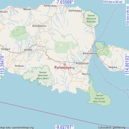
Purwojoyo GPS coordinates[2]
8° 19' 55.2" South, 114° 5' 52.44" East
| Map corner | latitude | longitude |
|---|---|---|
| Upper-left | -7.63569°, | 113.39478° |
| Center: | -8.332°, | 114.0979° |
| Lower-right: | -9.02707°, | 114.80103° |
| Map W x H: | 154.7×154.7 km | = 96.1×96.1mi |
| max Lat: | 5.88969° ⇑78.1% North |
| Purwojoyo: | -8.332° |
| min Lat: | ⇓21.9% South -10.934° |
| min Long | Purwojoyo | max Long |
| 95.1345° | 114.0979° | 140.9419° |
| W 67.9%⇐ | ⇒32.1% E |
Elevation
Elevation of Purwojoyo is 238 m = 781 ft, and this is 8.3 m = 27 ft above average elevation for this country.
| Max E: |
3185 m = 10449 ft | 33.9% |
| Purwojoyo | 238 m 781 ft | |
| Avg. | 229.7 m = 754 ft | |
Min E: |
-1 m = -3 ft | 66.1% |
See also: Indonesia elevation on elevation.city.
Geographical zone
Purwojoyo is located in South Torrid zone (between Equator and Tropic of Capricorn). Distance of Equator is 926.4 km =575.6 mi to North.| Distance of | km | miles | from Purwojoyo |
|---|---|---|---|
| Equator | 926.4 | 575.6 | to North |
| Tropic Capricorn | 1679.5 | 1043.6 | to South |
| Antarctic Circle | 6474.7 | 4023.2 | to South |
| South Pole | 9080.6 | 5642.4 | to South |


Nearby cities:
15 places around Purwojoyo: (largest is in red/bold)
• Balokan
6.8 km =4.2 mi,  159°
159°
• Dadapan
10.7 km =6.6 mi,  84°
84°
• Gambiran Satu
8.7 km =5.4 mi,  142°
142°
• Genteng
6.9 km =4.3 mi,  123°
123°
• Karangarjo
5.9 km =3.7 mi,  291°
291°
• Karangharjo Kidul
5.9 km =3.7 mi, 291°
• Kopen
6.5 km =4 mi, 120°
• Kopen
8.7 km =5.4 mi,  72°
72°
• Krajan
5.4 km =3.4 mi,  131°
131°
• Krajan
5.6 km =3.5 mi, 164°
• Krajan
8 km =5 mi, 117°
• Krajan
11.4 km =7.1 mi, 79°
• Krajan Tengah
7.9 km =4.9 mi, 293°
• Sempu
6.1 km =3.8 mi, 75°
• Sepanjang
6.2 km =3.9 mi,  303°
303°
Sources, notices
• [Note1] Compared only with cities in Indonesia existing in our database
• [Src1] Map data: © OpenStreetMap contributors (CC-BY-SA)
• [Src2] Other city data from geonames.org with taken over terms of usage.
• [Src3] Geographical zone / Annual Mean Temperature by Robert A. Rohde @ Wikipedia
