Banjar Sekaan geodata
Banjar Sekaan (Bali) is a seat of a fourth-order administrative division; located in Indonesia in Asia/Makassar (GMT+8) time zone. In our database, there are 407 cities with bigger population. Compared to other cities in Indonesia, 77.7% of cities are located further ↑North; 73.8% of cities are located further ←West and 97.9% of cities have lower elevation than Banjar Sekaan. Note1


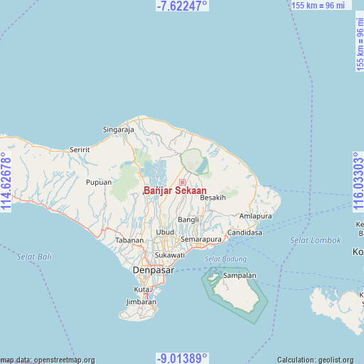
Banjar Sekaan GPS coordinates[2]
8° 19' 7.68" South, 115° 19' 47.64" East
| Map corner | latitude | longitude |
|---|---|---|
| Upper-left | -7.62247°, | 114.62678° |
| Center: | -8.3188°, | 115.3299° |
| Lower-right: | -9.01389°, | 116.03303° |
| Map W x H: | 154.7×154.7 km | = 96.1×96.1mi |
| max Lat: | 5.88969° ⇑77.7% North |
| Banjar Sekaan: | -8.3188° |
| min Lat: | ⇓22.3% South -10.934° |
| min Long | Banjar Sekaan | max Long |
| 95.1345° | 115.3299° | 140.9419° |
| W 73.8%⇐ | ⇒26.2% E |
Elevation
Elevation of Banjar Sekaan is 1029 m = 3376 ft, and this is 799.3 m = 2622 ft above average elevation for this country.
| Max E: |
3185 m = 10449 ft | 2.1% |
| Banjar Sekaan | 1029 m 3376 ft | |
| Avg. | 229.7 m = 754 ft | |
Min E: |
-1 m = -3 ft | 97.9% |
See also: Indonesia elevation on elevation.city.
Geographical zone
Banjar Sekaan is located in South Torrid zone (between Equator and Tropic of Capricorn). Distance of Equator is 925 km =574.8 mi to North.| Distance of | km | miles | from Banjar Sekaan |
|---|---|---|---|
| Equator | 925 | 574.8 | to North |
| Tropic Capricorn | 1681 | 1044.5 | to South |
| Antarctic Circle | 6476.2 | 4024.1 | to South |
| South Pole | 9082.1 | 5643.4 | to South |


Nearby cities:
15 places around Banjar Sekaan: (largest is in red/bold)
• Banjar Abuan
1.9 km =1.2 mi,  263°
263°
• Banjar Banua
3.9 km =2.4 mi, 261°
• Banjar Bayungcerik
5.1 km =3.2 mi,  298°
298°
• Banjar Belancan
4.8 km =3 mi,  331°
331°
• Banjar Bonyoh
1.3 km =0.8 mi,  322°
322°
• Banjar Katung
2.9 km =1.8 mi,  288°
288°
• Banjar Kedisan
7.1 km =4.4 mi,  52°
52°
• Banjar Kerta
5.2 km =3.2 mi,  245°
245°
• Banjar Langgahan Kangin
6.5 km =4 mi,  274°
274°
• Banjar Lembean
6.4 km =4 mi, 298°
• Banjar Mangguh
4.1 km =2.5 mi, 287°
• Banjar Manikliyu
6.4 km =4 mi,  313°
313°
• Banjar Pengotan
3.6 km =2.2 mi,  102°
102°
• Banjar Sekardadi
2.2 km =1.4 mi,  70°
70°
• Banjar Seribatu
5.7 km =3.5 mi,  164°
164°
Sources, notices
• [Note1] Compared only with cities in Indonesia existing in our database
• [Src1] Map data: © OpenStreetMap contributors (CC-BY-SA)
• [Src2] Other city data from geonames.org with taken over terms of usage.
• [Src3] Geographical zone / Annual Mean Temperature by Robert A. Rohde @ Wikipedia
