Banjar Pengotan geodata
Banjar Pengotan (Bali) is a seat of a fourth-order administrative division; located in Indonesia in Asia/Makassar (GMT+8) time zone. In our database, there are 407 cities with bigger population. Compared to other cities in Indonesia, 77.9% of cities are located further ↑North; 74% of cities are located further ←West and 98% of cities have lower elevation than Banjar Pengotan. Note1


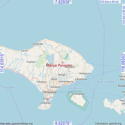
Banjar Pengotan GPS coordinates[2]
8° 19' 32.52" South, 115° 21' 44.28" East
| Map corner | latitude | longitude |
|---|---|---|
| Upper-left | -7.62938°, | 114.65918° |
| Center: | -8.3257°, | 115.3623° |
| Lower-right: | -9.02078°, | 116.06543° |
| Map W x H: | 154.7×154.7 km | = 96.1×96.1mi |
| max Lat: | 5.88969° ⇑77.9% North |
| Banjar Pengotan: | -8.3257° |
| min Lat: | ⇓22.1% South -10.934° |
| min Long | Banjar Pengotan | max Long |
| 95.1345° | 115.3623° | 140.9419° |
| W 74%⇐ | ⇒26% E |
Elevation
Elevation of Banjar Pengotan is 1037 m = 3402 ft, and this is 807.3 m = 2649 ft above average elevation for this country.
| Max E: |
3185 m = 10449 ft | 2% |
| Banjar Pengotan | 1037 m 3402 ft | |
| Avg. | 229.7 m = 754 ft | |
Min E: |
-1 m = -3 ft | 98% |
See also: Indonesia elevation on elevation.city.
Geographical zone
Banjar Pengotan is located in South Torrid zone (between Equator and Tropic of Capricorn). Distance of Equator is 925.7 km =575.2 mi to North.| Distance of | km | miles | from Banjar Pengotan |
|---|---|---|---|
| Equator | 925.7 | 575.2 | to North |
| Tropic Capricorn | 1680.2 | 1044 | to South |
| Antarctic Circle | 6475.4 | 4023.6 | to South |
| South Pole | 9081.3 | 5642.9 | to South |


Nearby cities:
15 places around Banjar Pengotan: (largest is in red/bold)
• Banjar Abuan
5.5 km =3.4 mi,  275°
275°
• Banjar Banua
7.4 km =4.6 mi,  271°
271°
• Banjar Belancan
7.7 km =4.8 mi,  310°
310°
• Banjar Bias
3.9 km =2.4 mi,  75°
75°
• Banjar Bonyoh
4.7 km =2.9 mi,  292°
292°
• Banjar Buahan
5.3 km =3.3 mi,  35°
35°
• Banjar Katung
6.6 km =4.1 mi, 285°
• Banjar Kayubihi
8 km =5 mi,  179°
179°
• Banjar Kedisan
5.5 km =3.4 mi,  21°
21°
• Banjar Mangguh
7.8 km =4.8 mi, 284°
• Banjar Sekaan
3.6 km =2.2 mi, 282°
• Banjar Sekardadi
2.1 km =1.3 mi,  315°
315°
• Banjar Seribatu
5.1 km =3.2 mi,  202°
202°
• Banjar Suter
4.2 km =2.6 mi,  60°
60°
• Banjar Tiga
6.4 km =4 mi,  188°
188°
Sources, notices
• [Note1] Compared only with cities in Indonesia existing in our database
• [Src1] Map data: © OpenStreetMap contributors (CC-BY-SA)
• [Src2] Other city data from geonames.org with taken over terms of usage.
• [Src3] Geographical zone / Annual Mean Temperature by Robert A. Rohde @ Wikipedia
