Simpanganduwet geodata
Simpanganduwet (East Java) is a seat of a fourth-order administrative division; located in Indonesia in Asia/Jakarta (GMT+7) time zone. In our database, there are 407 cities with bigger population. Compared to other cities in Indonesia, 62.5% of cities are located further ↑North; 57.8% of cities are located further ←West and 94.6% of cities have lower elevation than Simpanganduwet. Note1


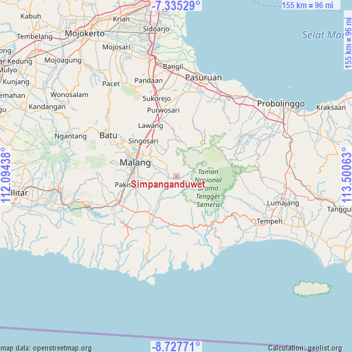
Simpanganduwet GPS coordinates[2]
8° 1' 55.56" South, 112° 47' 51" East
| Map corner | latitude | longitude |
|---|---|---|
| Upper-left | -7.33529°, | 112.09438° |
| Center: | -8.0321°, | 112.7975° |
| Lower-right: | -8.72771°, | 113.50063° |
| Map W x H: | 154.8×154.8 km | = 96.2×96.2mi |
| max Lat: | 5.88969° ⇑62.5% North |
| Simpanganduwet: | -8.0321° |
| min Lat: | ⇓37.5% South -10.934° |
| min Long | Simpanganduwet | max Long |
| 95.1345° | 112.7975° | 140.9419° |
| W 57.8%⇐ | ⇒42.2% E |
Elevation
Elevation of Simpanganduwet is 798 m = 2618 ft, and this is 568.3 m = 1865 ft above average elevation for this country.
| Max E: |
3185 m = 10449 ft | 5.4% |
| Simpanganduwet | 798 m 2618 ft | |
| Avg. | 229.7 m = 754 ft | |
Min E: |
-1 m = -3 ft | 94.6% |
See also: Indonesia elevation on elevation.city.
Geographical zone
Simpanganduwet is located in South Torrid zone (between Equator and Tropic of Capricorn). Distance of Equator is 893.1 km =554.9 mi to North.| Distance of | km | miles | from Simpanganduwet |
|---|---|---|---|
| Equator | 893.1 | 554.9 | to North |
| Tropic Capricorn | 1712.8 | 1064.3 | to South |
| Antarctic Circle | 6508.1 | 4043.9 | to South |
| South Pole | 9114 | 5663.2 | to South |


Nearby cities:
15 places around Simpanganduwet: (largest is in red/bold)
• Belung Satu
3.1 km =1.9 mi,  266°
266°
• Gubugklakah Barat
4.1 km =2.5 mi,  76°
76°
• Karanganyar
5.8 km =3.6 mi,  230°
230°
• Kedampul
3 km =1.9 mi,  34°
34°
• Keden
6.1 km =3.8 mi, 267°
• Krajan
2.8 km =1.7 mi,  58°
58°
• Krajan
3.7 km =2.3 mi,  304°
304°
• Ngebruk
6.9 km =4.3 mi,  256°
256°
• Nongkosewu
4 km =2.5 mi,  247°
247°
• Pandansari
4.3 km =2.7 mi,  169°
169°
• Poncokusumo
2.6 km =1.6 mi,  148°
148°
• Tumpang
4.7 km =2.9 mi,  308°
308°
• Tumpang Satu
4.9 km =3 mi, 305°
• Wates
3.4 km =2.1 mi, 252°
• Wonorejo
2.3 km =1.4 mi, 230°
Sources, notices
• [Note1] Compared only with cities in Indonesia existing in our database
• [Src1] Map data: © OpenStreetMap contributors (CC-BY-SA)
• [Src2] Other city data from geonames.org with taken over terms of usage.
• [Src3] Geographical zone / Annual Mean Temperature by Robert A. Rohde @ Wikipedia
