Dukuhmencek Lor geodata
Dukuhmencek Lor (East Java) is a seat of a fourth-order administrative division; located in Indonesia in Asia/Jakarta (GMT+7) time zone. In our database, there are 407 cities with bigger population. Compared to other cities in Indonesia, 69.7% of cities are located further ↑North; 64% of cities are located further ←West and 52.3% of cities have higher elevation than Dukuhmencek Lor. Note1


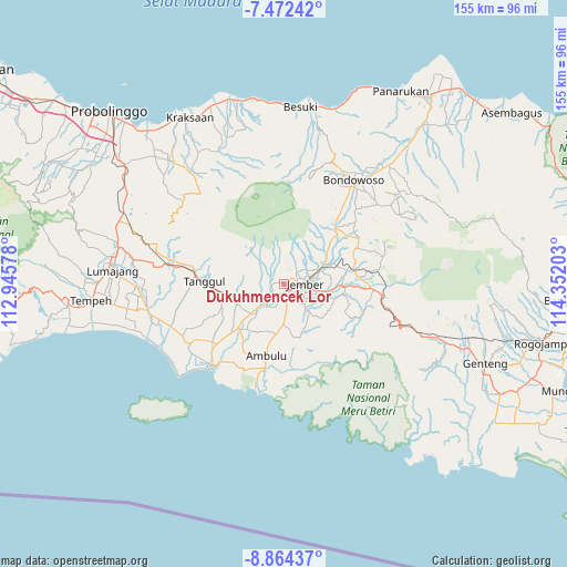
Dukuhmencek Lor GPS coordinates[2]
8° 10' 8.4" South, 113° 38' 56.04" East
| Map corner | latitude | longitude |
|---|---|---|
| Upper-left | -7.47242°, | 112.94578° |
| Center: | -8.169°, | 113.6489° |
| Lower-right: | -8.86437°, | 114.35203° |
| Map W x H: | 154.8×154.8 km | = 96.2×96.2mi |
| max Lat: | 5.88969° ⇑69.7% North |
| Dukuhmencek Lor: | -8.169° |
| min Lat: | ⇓30.3% South -10.934° |
| min Long | Dukuhmencek Lor | max Long |
| 95.1345° | 113.6489° | 140.9419° |
| W 64%⇐ | ⇒36% E |
Elevation
Elevation of Dukuhmencek Lor is 94 m = 308 ft, and this is 135.7 m = 445 ft below average elevation for this country.
| Max E: |
3185 m = 10449 ft | 52.3% |
| Avg. | 229.7 m = 754 ft | |
| Dukuhmencek Lor | 94 m = 308 ft | |
Min E: |
-1 m = -3 ft | 47.7% |
See also: Indonesia elevation on elevation.city.
Geographical zone
Dukuhmencek Lor is located in South Torrid zone (between Equator and Tropic of Capricorn). Distance of Equator is 908.3 km =564.4 mi to North.| Distance of | km | miles | from Dukuhmencek Lor |
|---|---|---|---|
| Equator | 908.3 | 564.4 | to North |
| Tropic Capricorn | 1697.6 | 1054.8 | to South |
| Antarctic Circle | 6492.9 | 4034.5 | to South |
| South Pole | 9098.8 | 5653.7 | to South |


Nearby cities:
15 places around Dukuhmencek Lor: (largest is in red/bold)
• Ajung
4.2 km =2.6 mi,  169°
169°
• Dukuhsia
4.5 km =2.8 mi,  229°
229°
• Gaplek
5 km =3.1 mi,  331°
331°
• Glagahwero
3.4 km =2.1 mi,  254°
254°
• Gugut
4.4 km =2.7 mi, 247°
• Jubung
3.3 km =2.1 mi,  202°
202°
• Kaliwates
2.9 km =1.8 mi,  120°
120°
• Kebonwaru Satu
3.1 km =1.9 mi,  55°
55°
• Krajan
2.6 km =1.6 mi,  136°
136°
• Krajan
2.7 km =1.7 mi,  48°
48°
• Mangli
2.5 km =1.6 mi, 173°
• Panti
2.5 km =1.6 mi,  273°
273°
• Serut
2.2 km =1.4 mi, 326°
• Sukorambi
2.2 km =1.4 mi, 53°
• Telengsari
4.9 km =3 mi,  106°
106°
Sources, notices
• [Note1] Compared only with cities in Indonesia existing in our database
• [Src1] Map data: © OpenStreetMap contributors (CC-BY-SA)
• [Src2] Other city data from geonames.org with taken over terms of usage.
• [Src3] Geographical zone / Annual Mean Temperature by Robert A. Rohde @ Wikipedia
