Banjar Delodsema geodata
Banjar Delodsema (Bali) is a seat of a fourth-order administrative division; located in Indonesia in Asia/Makassar (GMT+8) time zone. In our database, there are 407 cities with bigger population. Compared to other cities in Indonesia, 86.8% of cities are located further ↑North; 71.8% of cities are located further ←West and 60.1% of cities have higher elevation than Banjar Delodsema. Note1


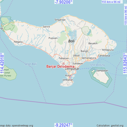
Banjar Delodsema GPS coordinates[2]
8° 35' 52.44" South, 115° 7' 23.88" East
| Map corner | latitude | longitude |
|---|---|---|
| Upper-left | -7.90206°, | 114.42018° |
| Center: | -8.5979°, | 115.1233° |
| Lower-right: | -9.29247°, | 115.82643° |
| Map W x H: | 154.6×154.6 km | = 96.1×96.1mi |
| max Lat: | 5.88969° ⇑86.8% North |
| Banjar Delodsema: | -8.5979° |
| min Lat: | ⇓13.2% South -10.934° |
| min Long | Banjar Delodsem | max Long |
| 95.1345° | 115.1233° | 140.9419° |
| W 71.8%⇐ | ⇒28.2% E |
Elevation
Elevation of Banjar Delodsema is 59 m = 194 ft, and this is 170.7 m = 560 ft below average elevation for this country.
| Max E: |
3185 m = 10449 ft | 60.1% |
| Avg. | 229.7 m = 754 ft | |
| Banjar Delodsema | 59 m = 194 ft | |
Min E: |
-1 m = -3 ft | 39.9% |
See also: Indonesia elevation on elevation.city.
Geographical zone
Banjar Delodsema is located in South Torrid zone (between Equator and Tropic of Capricorn). Distance of Equator is 956 km =594 mi to North.| Distance of | km | miles | from Banjar Delodsema |
|---|---|---|---|
| Equator | 956 | 594 | to North |
| Tropic Capricorn | 1649.9 | 1025.2 | to South |
| Antarctic Circle | 6445.2 | 4004.9 | to South |
| South Pole | 9051.1 | 5624.1 | to South |


Nearby cities:
15 places around Banjar Delodsema: (largest is in red/bold)
• Banjar Batanbuah
2 km =1.2 mi,  255°
255°
• Banjar Belatung
1 km =0.6 mi,  354°
354°
• Banjar Bengkelgede
3.4 km =2.1 mi,  288°
288°
• Banjar Dauh Peken
2.3 km =1.4 mi,  69°
69°
• Banjar Dauhrurung
3 km =1.9 mi,  275°
275°
• Banjar Gunungpande
3.1 km =1.9 mi,  130°
130°
• Banjar Jagasatru
4.4 km =2.7 mi,  23°
23°
• Banjar Kerobokan
2.3 km =1.4 mi,  168°
168°
• Banjar Laing
2.3 km =1.4 mi,  28°
28°
• Banjar Lalangpasek
2.4 km =1.5 mi,  91°
91°
• Banjar Mundeh
2.6 km =1.6 mi,  41°
41°
• Banjar Pangkungtibah Selatan
3.6 km =2.2 mi, 276°
• Banjar Pejaten
3 km =1.9 mi,  323°
323°
• Banjar Puseh
3.9 km =2.4 mi, 22°
• Banjar Sengguan
2.4 km =1.5 mi,  325°
325°
Sources, notices
• [Note1] Compared only with cities in Indonesia existing in our database
• [Src1] Map data: © OpenStreetMap contributors (CC-BY-SA)
• [Src2] Other city data from geonames.org with taken over terms of usage.
• [Src3] Geographical zone / Annual Mean Temperature by Robert A. Rohde @ Wikipedia
