Banjar Mundeh geodata
Banjar Mundeh (Bali) is a seat of a fourth-order administrative division; located in Indonesia in Asia/Makassar (GMT+8) time zone. In our database, there are 407 cities with bigger population. Compared to other cities in Indonesia, 86.4% of cities are located further ↑North; 72% of cities are located further ←West and 54% of cities have higher elevation than Banjar Mundeh. Note1


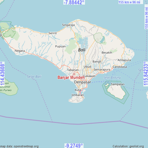
Banjar Mundeh GPS coordinates[2]
8° 34' 49.08" South, 115° 8' 21.12" East
| Map corner | latitude | longitude |
|---|---|---|
| Upper-left | -7.88442°, | 114.43608° |
| Center: | -8.5803°, | 115.1392° |
| Lower-right: | -9.2749°, | 115.84233° |
| Map W x H: | 154.6×154.6 km | = 96.1×96.1mi |
| max Lat: | 5.88969° ⇑86.4% North |
| Banjar Mundeh: | -8.5803° |
| min Lat: | ⇓13.6% South -10.934° |
| min Long | Banjar Mundeh | max Long |
| 95.1345° | 115.1392° | 140.9419° |
| W 72%⇐ | ⇒28% E |
Elevation
Elevation of Banjar Mundeh is 89 m = 292 ft, and this is 140.7 m = 462 ft below average elevation for this country.
| Max E: |
3185 m = 10449 ft | 54% |
| Avg. | 229.7 m = 754 ft | |
| Banjar Mundeh | 89 m = 292 ft | |
Min E: |
-1 m = -3 ft | 46% |
See also: Indonesia elevation on elevation.city.
Geographical zone
Banjar Mundeh is located in South Torrid zone (between Equator and Tropic of Capricorn). Distance of Equator is 954 km =592.8 mi to North.| Distance of | km | miles | from Banjar Mundeh |
|---|---|---|---|
| Equator | 954 | 592.8 | to North |
| Tropic Capricorn | 1651.9 | 1026.4 | to South |
| Antarctic Circle | 6447.1 | 4006 | to South |
| South Pole | 9053 | 5625.3 | to South |


Nearby cities:
15 places around Banjar Mundeh: (largest is in red/bold)
• Banjar Abiantuwung
2.7 km =1.7 mi,  22°
22°
• Banjar Banjaranyar
3.9 km =2.4 mi,  8°
8°
• Banjar Belatung
2.1 km =1.3 mi,  241°
241°
• Banjar Bongangede
3.3 km =2.1 mi,  319°
319°
• Banjar Cice
3.6 km =2.2 mi,  107°
107°
• Banjar Danginpangkung
2.8 km =1.7 mi,  78°
78°
• Banjar Dauh Peken
1.2 km =0.7 mi,  161°
161°
• Banjar Delodsema
2.6 km =1.6 mi,  221°
221°
• Banjar Jagasatru
2.1 km =1.3 mi,  359°
359°
• Banjar Jumbayah
3.4 km =2.1 mi,  59°
59°
• Banjar Laing
0.6 km =0.4 mi,  279°
279°
• Banjar Lalangpasek
2.1 km =1.3 mi, 161°
• Banjar Pejaten
3.6 km =2.2 mi, 277°
• Banjar Puseh
1.7 km =1.1 mi,  352°
352°
• Banjar Sengguan
3.1 km =1.9 mi,  270°
270°
Sources, notices
• [Note1] Compared only with cities in Indonesia existing in our database
• [Src1] Map data: © OpenStreetMap contributors (CC-BY-SA)
• [Src2] Other city data from geonames.org with taken over terms of usage.
• [Src3] Geographical zone / Annual Mean Temperature by Robert A. Rohde @ Wikipedia
