Banjar Desa geodata
Banjar Desa (Bali) is a seat of a fourth-order administrative division; located in Indonesia in Asia/Makassar (GMT+8) time zone. In our database, there are 407 cities with bigger population. Compared to other cities in Indonesia, 86.4% of cities are located further ↑North; 72.9% of cities are located further ←West and 51.1% of cities have higher elevation than Banjar Desa. Note1


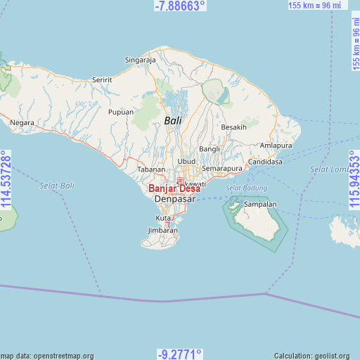
Banjar Desa GPS coordinates[2]
8° 34' 57" South, 115° 14' 25.44" East
| Map corner | latitude | longitude |
|---|---|---|
| Upper-left | -7.88663°, | 114.53728° |
| Center: | -8.5825°, | 115.2404° |
| Lower-right: | -9.2771°, | 115.94353° |
| Map W x H: | 154.6×154.6 km | = 96.1×96.1mi |
| max Lat: | 5.88969° ⇑86.4% North |
| Banjar Desa: | -8.5825° |
| min Lat: | ⇓13.6% South -10.934° |
| min Long | Banjar Desa | max Long |
| 95.1345° | 115.2404° | 140.9419° |
| W 72.9%⇐ | ⇒27.1% E |
Elevation
Elevation of Banjar Desa is 98 m = 322 ft, and this is 131.7 m = 432 ft below average elevation for this country.
| Max E: |
3185 m = 10449 ft | 51.1% |
| Avg. | 229.7 m = 754 ft | |
| Banjar Desa | 98 m = 322 ft | |
Min E: |
-1 m = -3 ft | 48.9% |
See also: Indonesia elevation on elevation.city.
Geographical zone
Banjar Desa is located in South Torrid zone (between Equator and Tropic of Capricorn). Distance of Equator is 954.3 km =593 mi to North.| Distance of | km | miles | from Banjar Desa |
|---|---|---|---|
| Equator | 954.3 | 593 | to North |
| Tropic Capricorn | 1651.6 | 1026.3 | to South |
| Antarctic Circle | 6446.9 | 4005.9 | to South |
| South Pole | 9052.8 | 5625.1 | to South |


Nearby cities:
15 places around Banjar Desa: (largest is in red/bold)
• Banjar Batur
3.5 km =2.2 mi,  237°
237°
• Banjar Bucu
3.8 km =2.4 mi,  264°
264°
• Banjar Cemenggon
6.6 km =4.1 mi,  317°
317°
• Banjar Jabejero
1.8 km =1.1 mi,  181°
181°
• Banjar Karangsuling
5.3 km =3.3 mi,  248°
248°
• Banjar Kayangan
4.6 km =2.9 mi,  195°
195°
• Banjar Keraman
6.8 km =4.2 mi,  332°
332°
• Banjar Kertajiwa
6.8 km =4.2 mi,  159°
159°
• Banjar Kertasari
5.5 km =3.4 mi,  217°
217°
• Banjar Mambalkajanan
4 km =2.5 mi, 332°
• Banjar Paangkelod
4.6 km =2.9 mi, 180°
• Banjar Parekan
2.7 km =1.7 mi,  284°
284°
• Banjar Pemangkalan
6.4 km =4 mi, 223°
• Banjar Sedang
1.3 km =0.8 mi,  352°
352°
• Banjar Tebongkang
6 km =3.7 mi,  3°
3°
Sources, notices
• [Note1] Compared only with cities in Indonesia existing in our database
• [Src1] Map data: © OpenStreetMap contributors (CC-BY-SA)
• [Src2] Other city data from geonames.org with taken over terms of usage.
• [Src3] Geographical zone / Annual Mean Temperature by Robert A. Rohde @ Wikipedia
