Jalasenga geodata
Jalasenga (East Nusa Tenggara) is a seat of a fourth-order administrative division; located in Indonesia in Asia/Makassar (GMT+8) time zone. In our database, there are 407 cities with bigger population. Compared to other cities in Indonesia, 84.5% of cities are located further ↑North; 87.5% of cities are located further ←West and 70.2% of cities have higher elevation than Jalasenga. Note1


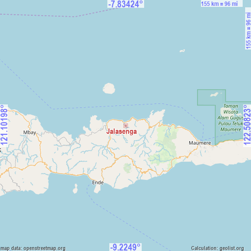
Jalasenga GPS coordinates[2]
8° 31' 48.72" South, 121° 48' 18.36" East
| Map corner | latitude | longitude |
|---|---|---|
| Upper-left | -7.83424°, | 121.10198° |
| Center: | -8.5302°, | 121.8051° |
| Lower-right: | -9.2249°, | 122.50823° |
| Map W x H: | 154.6×154.6 km | = 96.1×96.1mi |
| max Lat: | 5.88969° ⇑84.5% North |
| Jalasenga: | -8.5302° |
| min Lat: | ⇓15.5% South -10.934° |
| min Long | Jalasenga | max Long |
| 95.1345° | 121.8051° | 140.9419° |
| W 87.5%⇐ | ⇒12.5% E |
Elevation
Elevation of Jalasenga is 32 m = 105 ft, and this is 197.7 m = 649 ft below average elevation for this country.
| Max E: |
3185 m = 10449 ft | 70.2% |
| Avg. | 229.7 m = 754 ft | |
| Jalasenga | 32 m = 105 ft | |
Min E: |
-1 m = -3 ft | 29.8% |
See also: Indonesia elevation on elevation.city.
Geographical zone
Jalasenga is located in South Torrid zone (between Equator and Tropic of Capricorn). Distance of Equator is 948.5 km =589.4 mi to North.| Distance of | km | miles | from Jalasenga |
|---|---|---|---|
| Equator | 948.5 | 589.4 | to North |
| Tropic Capricorn | 1657.4 | 1029.9 | to South |
| Antarctic Circle | 6452.7 | 4009.5 | to South |
| South Pole | 9058.6 | 5628.8 | to South |


Nearby cities:
15 places around Jalasenga: (largest is in red/bold)
• Aelande
11.4 km =7.1 mi,  230°
230°
• Detukeli
11.4 km =7.1 mi,  172°
172°
• Detuwane
2.3 km =1.4 mi,  324°
324°
• Kanganara
11.1 km =6.9 mi,  159°
159°
• Loboniki
13.5 km =8.4 mi,  81°
81°
• Lokolande
18.3 km =11.4 mi,  88°
88°
• Londe
11.9 km =7.4 mi,  224°
224°
• Maurole
2.2 km =1.4 mi,  351°
351°
• Nggesa
8.2 km =5.1 mi, 169°
• Niopanda
11.1 km =6.9 mi,  102°
102°
• Nuamuri
8.8 km =5.5 mi,  135°
135°
• Sokonaja
17.5 km =10.9 mi,  112°
112°
• Tendaleo
17.4 km =10.8 mi, 221°
• Welamosa
12.8 km =8 mi, 228°
• Wolomuku
10.9 km =6.8 mi, 220°
Sources, notices
• [Note1] Compared only with cities in Indonesia existing in our database
• [Src1] Map data: © OpenStreetMap contributors (CC-BY-SA)
• [Src2] Other city data from geonames.org with taken over terms of usage.
• [Src3] Geographical zone / Annual Mean Temperature by Robert A. Rohde @ Wikipedia
