Sangia geodata
Sangia (West Nusa Tenggara) is a seat of a fourth-order administrative division; located in Indonesia in Asia/Makassar (GMT+8) time zone. In our database, there are 407 cities with bigger population. Compared to other cities in Indonesia, 85.8% of cities are located further ↑North; 80.7% of cities are located further ←West and 74.9% of cities have higher elevation than Sangia. Note1


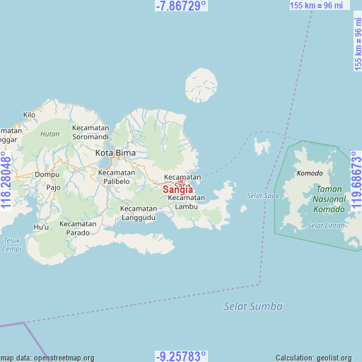
Sangia GPS coordinates[2]
8° 33' 47.52" South, 118° 59' 0.96" East
| Map corner | latitude | longitude |
|---|---|---|
| Upper-left | -7.86729°, | 118.28048° |
| Center: | -8.5632°, | 118.9836° |
| Lower-right: | -9.25783°, | 119.68673° |
| Map W x H: | 154.6×154.6 km | = 96.1×96.1mi |
| max Lat: | 5.88969° ⇑85.8% North |
| Sangia: | -8.5632° |
| min Lat: | ⇓14.2% South -10.934° |
| min Long | Sangia | max Long |
| 95.1345° | 118.9836° | 140.9419° |
| W 80.7%⇐ | ⇒19.3% E |
Elevation
Elevation of Sangia is 25 m = 82 ft, and this is 204.7 m = 672 ft below average elevation for this country.
| Max E: |
3185 m = 10449 ft | 74.9% |
| Avg. | 229.7 m = 754 ft | |
| Sangia | 25 m = 82 ft | |
Min E: |
-1 m = -3 ft | 25.1% |
See also: Indonesia elevation on elevation.city.
Geographical zone
Sangia is located in South Torrid zone (between Equator and Tropic of Capricorn). Distance of Equator is 952.1 km =591.6 mi to North.| Distance of | km | miles | from Sangia |
|---|---|---|---|
| Equator | 952.1 | 591.6 | to North |
| Tropic Capricorn | 1653.8 | 1027.6 | to South |
| Antarctic Circle | 6449 | 4007.2 | to South |
| South Pole | 9054.9 | 5626.5 | to South |


Nearby cities:
15 places around Sangia: (largest is in red/bold)
• Balai
4 km =2.5 mi,  181°
181°
• Bau
1.3 km =0.8 mi,  273°
273°
• Bombo
6.4 km =4 mi,  149°
149°
• Kalede
1 km =0.6 mi, 154°
• Kowo
4 km =2.5 mi,  38°
38°
• Lanta Timur
6.3 km =3.9 mi,  164°
164°
• Melati
6.2 km =3.9 mi, 266°
• Nae
0.3 km =0.2 mi,  234°
234°
• Naebugis
3 km =1.9 mi,  121°
121°
• Naru
1.4 km =0.9 mi,  133°
133°
• Pataha
4.7 km =2.9 mi, 37°
• Raioi
0.5 km =0.3 mi, 270°
• Rasabau
0.3 km =0.2 mi, 163°
• Sape
0.4 km =0.2 mi, 184°
• Sukamaju
1.7 km =1.1 mi, 226°
Sources, notices
• [Note1] Compared only with cities in Indonesia existing in our database
• [Src1] Map data: © OpenStreetMap contributors (CC-BY-SA)
• [Src2] Other city data from geonames.org with taken over terms of usage.
• [Src3] Geographical zone / Annual Mean Temperature by Robert A. Rohde @ Wikipedia
