Asahbadung geodata
Asahbadung (Bali) is a seat of a fourth-order administrative division; located in Indonesia in Asia/Makassar (GMT+8) time zone. In our database, there are 407 cities with bigger population. Compared to other cities in Indonesia, 78% of cities are located further ↑North; 70.4% of cities are located further ←West and 77.9% of cities have lower elevation than Asahbadung. Note1


Asahbadung GPS coordinates[2]
8° 19' 40.08" South, 114° 54' 19.8" East
| Map corner | latitude | longitude |
|---|---|---|
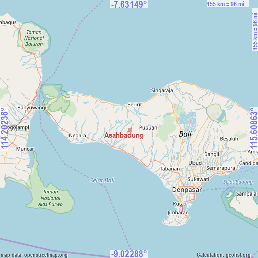
| Upper-left | -7.63149°, | 114.20238° |
| Center: | -8.3278°, | 114.9055° |
| Lower-right: | -9.02288°, | 115.60863° |
| Map W x H: | 154.7×154.7 km | = 96.1×96.1mi |
| max Lat: | 5.88969° ⇑78% North |
| Asahbadung: | -8.3278° |
| min Lat: | ⇓22% South -10.934° |
| min Long | Asahbadung | max Long |
| 95.1345° | 114.9055° | 140.9419° |
| W 70.4%⇐ | ⇒29.6% E |
Elevation
Elevation of Asahbadung is 396 m = 1299 ft, and this is 166.3 m = 546 ft above average elevation for this country.
| Max E: |
3185 m = 10449 ft | 22.1% |
| Asahbadung | 396 m 1299 ft | |
| Avg. | 229.7 m = 754 ft | |
Min E: |
-1 m = -3 ft | 77.9% |
See also: Indonesia elevation on elevation.city.
Geographical zone
Asahbadung is located in South Torrid zone (between Equator and Tropic of Capricorn). Distance of Equator is 926 km =575.4 mi to North.| Distance of | km | miles | from Asahbadung |
|---|---|---|---|
| Equator | 926 | 575.4 | to North |
| Tropic Capricorn | 1680 | 1043.9 | to South |
| Antarctic Circle | 6475.2 | 4023.5 | to South |
| South Pole | 9081.1 | 5642.7 | to South |


Nearby cities:
15 places around Asahbadung: (largest is in red/bold)
• Baleagung
9.2 km =5.7 mi,  17°
17°
• Banjar Asahduren
9.8 km =6.1 mi,  216°
216°
• Bantiran
9.6 km =6 mi,  77°
77°
• Bongancina Kaja
4.9 km =3 mi,  98°
98°
• Kanginan
9.6 km =6 mi,  61°
61°
• Klau
9.1 km =5.7 mi, 95°
• Lebahseri
9.1 km =5.7 mi, 17°
• Manggissari
5.2 km =3.2 mi,  192°
192°
• Munduktemu Kelod
7.2 km =4.5 mi, 104°
• Sepang
2.5 km =1.6 mi,  31°
31°
• Subuk
9 km =5.6 mi, 59°
• Tegalasih
4.5 km =2.8 mi,  72°
72°
• Telaga
8.3 km =5.2 mi,  36°
36°
• Tista
3.2 km =2 mi,  147°
147°
• Titab
8.7 km =5.4 mi, 42°
Sources, notices
• [Note1] Compared only with cities in Indonesia existing in our database
• [Src1] Map data: © OpenStreetMap contributors (CC-BY-SA)
• [Src2] Other city data from geonames.org with taken over terms of usage.
• [Src3] Geographical zone / Annual Mean Temperature by Robert A. Rohde @ Wikipedia
