Sepang geodata
Sepang (Bali) is a seat of a fourth-order administrative division; located in Indonesia in Asia/Makassar (GMT+8) time zone. In our database, there are 407 cities with bigger population. Compared to other cities in Indonesia, 77.2% of cities are located further ↑North; 70.4% of cities are located further ←West and 81% of cities have lower elevation than Sepang. Note1


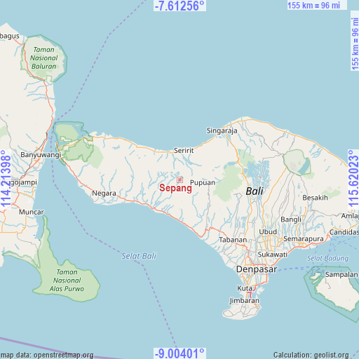
Sepang GPS coordinates[2]
8° 18' 32.04" South, 114° 55' 1.56" East
| Map corner | latitude | longitude |
|---|---|---|
| Upper-left | -7.61256°, | 114.21398° |
| Center: | -8.3089°, | 114.9171° |
| Lower-right: | -9.00401°, | 115.62023° |
| Map W x H: | 154.7×154.7 km | = 96.1×96.1mi |
| max Lat: | 5.88969° ⇑77.2% North |
| Sepang: | -8.3089° |
| min Lat: | ⇓22.8% South -10.934° |
| min Long | Sepang | max Long |
| 95.1345° | 114.9171° | 140.9419° |
| W 70.4%⇐ | ⇒29.6% E |
Elevation
Elevation of Sepang is 448 m = 1470 ft, and this is 218.3 m = 716 ft above average elevation for this country.
| Max E: |
3185 m = 10449 ft | 19% |
| Sepang | 448 m 1470 ft | |
| Avg. | 229.7 m = 754 ft | |
Min E: |
-1 m = -3 ft | 81% |
See also: Indonesia elevation on elevation.city.
Geographical zone
Sepang is located in South Torrid zone (between Equator and Tropic of Capricorn). Distance of Equator is 923.9 km =574.1 mi to North.| Distance of | km | miles | from Sepang |
|---|---|---|---|
| Equator | 923.9 | 574.1 | to North |
| Tropic Capricorn | 1682.1 | 1045.2 | to South |
| Antarctic Circle | 6477.3 | 4024.8 | to South |
| South Pole | 9083.2 | 5644 | to South |


Nearby cities:
15 places around Sepang: (largest is in red/bold)
• Asahbadung
2.5 km =1.6 mi,  211°
211°
• Baleagung
6.8 km =4.2 mi,  12°
12°
• Bongancina Kaja
4.5 km =2.8 mi,  128°
128°
• Busungbiu
8 km =5 mi,  43°
43°
• Kanginan
7.5 km =4.7 mi,  71°
71°
• Kauhan
7.6 km =4.7 mi,  52°
52°
• Lebahseri
6.7 km =4.2 mi, 12°
• Manggissari
7.6 km =4.7 mi,  198°
198°
• Munduktemu Kelod
6.9 km =4.3 mi,  124°
124°
• Subuk
6.9 km =4.3 mi, 69°
• Tegalasih
3.1 km =1.9 mi,  103°
103°
• Telaga
5.9 km =3.7 mi, 38°
• Tista
4.9 km =3 mi,  174°
174°
• Titab
6.3 km =3.9 mi, 46°
• Yatnyaketi
8.1 km =5 mi, 10°
Sources, notices
• [Note1] Compared only with cities in Indonesia existing in our database
• [Src1] Map data: © OpenStreetMap contributors (CC-BY-SA)
• [Src2] Other city data from geonames.org with taken over terms of usage.
• [Src3] Geographical zone / Annual Mean Temperature by Robert A. Rohde @ Wikipedia
