Kapakabisa geodata
Kapakabisa (East Nusa Tenggara) is a seat of a fourth-order administrative division; located in Indonesia in Asia/Makassar (GMT+8) time zone. In our database, there are 407 cities with bigger population. Compared to other cities in Indonesia, 94.9% of cities are located further ↑North; 81.3% of cities are located further ←West and 62.2% of cities have lower elevation than Kapakabisa. Note1


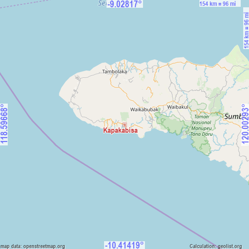
Kapakabisa GPS coordinates[2]
9° 43' 18.84" South, 119° 17' 59.28" East
| Map corner | latitude | longitude |
|---|---|---|
| Upper-left | -9.02817°, | 118.59668° |
| Center: | -9.7219°, | 119.2998° |
| Lower-right: | -10.41419°, | 120.00293° |
| Map W x H: | 154.1×154.1 km | = 95.8×95.8mi |
| max Lat: | 5.88969° ⇑94.9% North |
| Kapakabisa: | -9.7219° |
| min Lat: | ⇓5.1% South -10.934° |
| min Long | Kapakabisa | max Long |
| 95.1345° | 119.2998° | 140.9419° |
| W 81.3%⇐ | ⇒18.7% E |
Elevation
Elevation of Kapakabisa is 187 m = 614 ft, and this is 42.7 m = 140 ft below average elevation for this country.
| Max E: |
3185 m = 10449 ft | 37.8% |
| Avg. | 229.7 m = 754 ft | |
| Kapakabisa | 187 m = 614 ft | |
Min E: |
-1 m = -3 ft | 62.2% |
See also: Indonesia elevation on elevation.city.
Geographical zone
Kapakabisa is located in South Torrid zone (between Equator and Tropic of Capricorn). Distance of Equator is 1081 km =671.7 mi to North.| Distance of | km | miles | from Kapakabisa |
|---|---|---|---|
| Equator | 1081 | 671.7 | to North |
| Tropic Capricorn | 1524.9 | 947.5 | to South |
| Antarctic Circle | 6320.2 | 3927.2 | to South |
| South Pole | 8926.1 | 5546.4 | to South |


Nearby cities:
15 places around Kapakabisa: (largest is in red/bold)
• Barakabita
6.7 km =4.2 mi,  90°
90°
• Bogorawatu
4.3 km =2.7 mi,  135°
135°
• Hodi
5 km =3.1 mi,  280°
280°
• Kabukarudi
6.6 km =4.1 mi, 92°
• Litibakul
15.1 km =9.4 mi,  80°
80°
• Maledona
9.4 km =5.8 mi, 90°
• Malulla
11.9 km =7.4 mi,  333°
333°
• Maredakalada
14.1 km =8.8 mi,  9°
9°
• Ngaduloda
8.4 km =5.2 mi,  66°
66°
• Padedewatu
11.5 km =7.1 mi,  104°
104°
• Puukadelu
14.4 km =8.9 mi,  56°
56°
• Waikabubak
12.8 km =8 mi,  49°
49°
• Waimadaka
12.3 km =7.6 mi, 82°
• Welibo
4.4 km =2.7 mi, 95°
• Wengaingo
5.2 km =3.2 mi, 103°
Sources, notices
• [Note1] Compared only with cities in Indonesia existing in our database
• [Src1] Map data: © OpenStreetMap contributors (CC-BY-SA)
• [Src2] Other city data from geonames.org with taken over terms of usage.
• [Src3] Geographical zone / Annual Mean Temperature by Robert A. Rohde @ Wikipedia
