Wengaingo geodata
Wengaingo (East Nusa Tenggara) is a seat of a fourth-order administrative division; located in Indonesia in Asia/Makassar (GMT+8) time zone. In our database, there are 407 cities with bigger population. Compared to other cities in Indonesia, 95.1% of cities are located further ↑North; 81.5% of cities are located further ←West and 50.6% of cities have lower elevation than Wengaingo. Note1


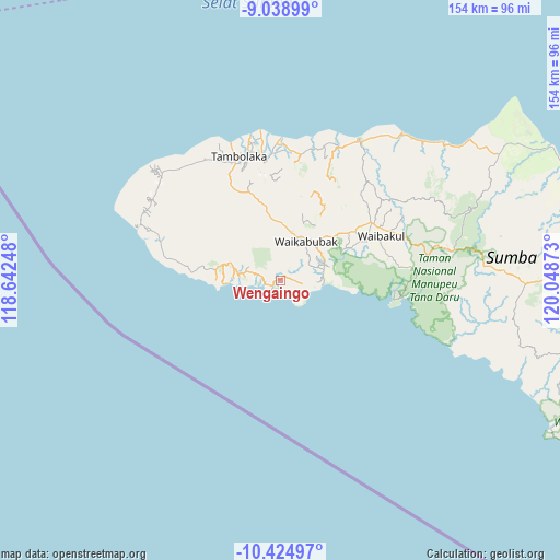
Wengaingo GPS coordinates[2]
9° 43' 57.72" South, 119° 20' 44.16" East
| Map corner | latitude | longitude |
|---|---|---|
| Upper-left | -9.03899°, | 118.64248° |
| Center: | -9.7327°, | 119.3456° |
| Lower-right: | -10.42497°, | 120.04873° |
| Map W x H: | 154.1×154.1 km | = 95.8×95.8mi |
| max Lat: | 5.88969° ⇑95.1% North |
| Wengaingo: | -9.7327° |
| min Lat: | ⇓4.9% South -10.934° |
| min Long | Wengaingo | max Long |
| 95.1345° | 119.3456° | 140.9419° |
| W 81.5%⇐ | ⇒18.5% E |
Elevation
Elevation of Wengaingo is 104 m = 341 ft, and this is 125.7 m = 412 ft below average elevation for this country.
| Max E: |
3185 m = 10449 ft | 49.4% |
| Avg. | 229.7 m = 754 ft | |
| Wengaingo | 104 m = 341 ft | |
Min E: |
-1 m = -3 ft | 50.6% |
See also: Indonesia elevation on elevation.city.
Geographical zone
Wengaingo is located in South Torrid zone (between Equator and Tropic of Capricorn). Distance of Equator is 1082.2 km =672.4 mi to North.| Distance of | km | miles | from Wengaingo |
|---|---|---|---|
| Equator | 1082.2 | 672.4 | to North |
| Tropic Capricorn | 1523.7 | 946.8 | to South |
| Antarctic Circle | 6319 | 3926.4 | to South |
| South Pole | 8924.9 | 5545.7 | to South |


Nearby cities:
15 places around Wengaingo: (largest is in red/bold)
• Barakabita
2 km =1.2 mi,  56°
56°
• Bogorawatu
2.7 km =1.7 mi,  227°
227°
• Hodi
10.2 km =6.3 mi,  282°
282°
• Kabukarudi
1.8 km =1.1 mi, 59°
• Kapakabisa
5.2 km =3.2 mi, 283°
• Lahihagalang
11.9 km =7.4 mi,  84°
84°
• Litibakul
10.6 km =6.6 mi,  69°
69°
• Maledona
4.5 km =2.8 mi, 76°
• Ngaduloda
5.3 km =3.3 mi,  30°
30°
• Padedewatu
6.3 km =3.9 mi,  105°
105°
• Praimutung
12.2 km =7.6 mi,  85°
85°
• Puukadelu
11.5 km =7.1 mi,  37°
37°
• Waikabubak
10.6 km =6.6 mi, 26°
• Waimadaka
7.6 km =4.7 mi, 69°
• Welibo
1 km =0.6 mi,  318°
318°
Sources, notices
• [Note1] Compared only with cities in Indonesia existing in our database
• [Src1] Map data: © OpenStreetMap contributors (CC-BY-SA)
• [Src2] Other city data from geonames.org with taken over terms of usage.
• [Src3] Geographical zone / Annual Mean Temperature by Robert A. Rohde @ Wikipedia
