Retenggoma geodata
Retenggoma (East Nusa Tenggara) is a seat of a fourth-order administrative division; located in Indonesia in Asia/Makassar (GMT+8) time zone. In our database, there are 407 cities with bigger population. Compared to other cities in Indonesia, 88.5% of cities are located further ↑North; 88.2% of cities are located further ←West and 89.5% of cities have lower elevation than Retenggoma. Note1


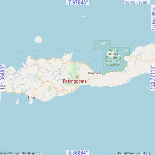
Retenggoma GPS coordinates[2]
8° 39' 58.32" South, 122° 4' 4.8" East
| Map corner | latitude | longitude |
|---|---|---|
| Upper-left | -7.97048°, | 121.36488° |
| Center: | -8.6662°, | 122.068° |
| Lower-right: | -9.36064°, | 122.77113° |
| Map W x H: | 154.6×154.6 km | = 96.1×96.1mi |
| max Lat: | 5.88969° ⇑88.5% North |
| Retenggoma: | -8.6662° |
| min Lat: | ⇓11.5% South -10.934° |
| min Long | Retenggoma | max Long |
| 95.1345° | 122.068° | 140.9419° |
| W 88.2%⇐ | ⇒11.8% E |
Elevation
Elevation of Retenggoma is 626 m = 2054 ft, and this is 396.3 m = 1300 ft above average elevation for this country.
| Max E: |
3185 m = 10449 ft | 10.5% |
| Retenggoma | 626 m 2054 ft | |
| Avg. | 229.7 m = 754 ft | |
Min E: |
-1 m = -3 ft | 89.5% |
See also: Indonesia elevation on elevation.city.
Geographical zone
Retenggoma is located in South Torrid zone (between Equator and Tropic of Capricorn). Distance of Equator is 963.6 km =598.8 mi to North.| Distance of | km | miles | from Retenggoma |
|---|---|---|---|
| Equator | 963.6 | 598.8 | to North |
| Tropic Capricorn | 1642.3 | 1020.5 | to South |
| Antarctic Circle | 6437.6 | 4000.1 | to South |
| South Pole | 9043.5 | 5619.4 | to South |


Nearby cities:
15 places around Retenggoma: (largest is in red/bold)
• Bloro
10.2 km =6.3 mi,  100°
100°
• Detuleda
3 km =1.9 mi,  296°
296°
• Detupia
8.8 km =5.5 mi,  217°
217°
• Feondari
3.9 km =2.4 mi,  267°
267°
• Funga
8.8 km =5.5 mi, 268°
• Hepang
10.3 km =6.4 mi,  118°
118°
• Lekebai
5.2 km =3.2 mi,  169°
169°
• Masebewa
8.4 km =5.2 mi, 216°
• Nirangkliung
3.1 km =1.9 mi,  66°
66°
• Nitakloang
10.5 km =6.5 mi,  92°
92°
• Riipua
5.7 km =3.5 mi,  152°
152°
• Riit
6.6 km =4.1 mi,  79°
79°
• Tilang
7.1 km =4.4 mi, 122°
• Watubura
9.4 km =5.8 mi,  127°
127°
• Woloau
6.5 km =4 mi, 296°
Sources, notices
• [Note1] Compared only with cities in Indonesia existing in our database
• [Src1] Map data: © OpenStreetMap contributors (CC-BY-SA)
• [Src2] Other city data from geonames.org with taken over terms of usage.
• [Src3] Geographical zone / Annual Mean Temperature by Robert A. Rohde @ Wikipedia
