Lekebai geodata
Lekebai (East Nusa Tenggara) is a seat of a third-order administrative division; located in Indonesia in Asia/Makassar (GMT+8) time zone. In our database, there are 407 cities with bigger population. Compared to other cities in Indonesia, 89.6% of cities are located further ↑North; 88.2% of cities are located further ←West and 53.2% of cities have lower elevation than Lekebai. Note1


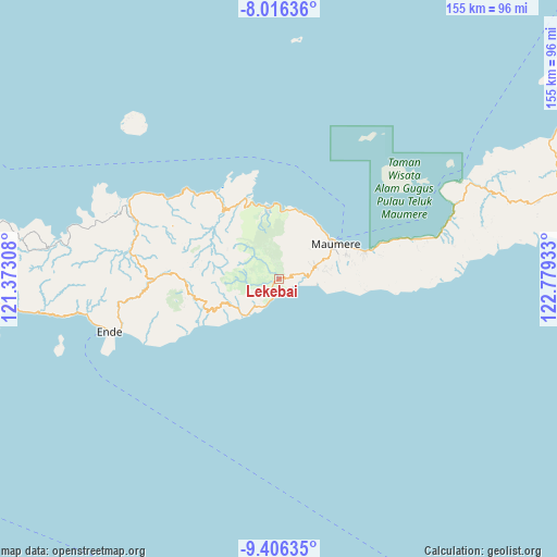
Lekebai GPS coordinates[2]
8° 42' 43.2" South, 122° 4' 34.32" East
| Map corner | latitude | longitude |
|---|---|---|
| Upper-left | -8.01636°, | 121.37308° |
| Center: | -8.712°, | 122.0762° |
| Lower-right: | -9.40635°, | 122.77933° |
| Map W x H: | 154.6×154.6 km | = 96.1×96.1mi |
| max Lat: | 5.88969° ⇑89.6% North |
| Lekebai: | -8.712° |
| min Lat: | ⇓10.4% South -10.934° |
| min Long | Lekebai | max Long |
| 95.1345° | 122.0762° | 140.9419° |
| W 88.2%⇐ | ⇒11.8% E |
Elevation
Elevation of Lekebai is 115 m = 377 ft, and this is 114.7 m = 376 ft below average elevation for this country.
| Max E: |
3185 m = 10449 ft | 46.8% |
| Avg. | 229.7 m = 754 ft | |
| Lekebai | 115 m = 377 ft | |
Min E: |
-1 m = -3 ft | 53.2% |
See also: Indonesia elevation on elevation.city.
Geographical zone
Lekebai is located in South Torrid zone (between Equator and Tropic of Capricorn). Distance of Equator is 968.7 km =601.9 mi to North.| Distance of | km | miles | from Lekebai |
|---|---|---|---|
| Equator | 968.7 | 601.9 | to North |
| Tropic Capricorn | 1637.2 | 1017.3 | to South |
| Antarctic Circle | 6432.5 | 3997 | to South |
| South Pole | 9038.4 | 5616.2 | to South |


Nearby cities:
15 places around Lekebai: (largest is in red/bold)
• Bloro
9.7 km =6 mi,  71°
71°
• Detuleda
7.4 km =4.6 mi,  330°
330°
• Detupia
6.6 km =4.1 mi,  253°
253°
• Feondari
6.9 km =4.3 mi,  315°
315°
• Hepang
8.1 km =5 mi,  88°
88°
• Masebewa
6.2 km =3.9 mi, 253°
• Mauloo
9.1 km =5.7 mi,  209°
209°
• Nirangkliung
6.6 km =4.1 mi,  17°
17°
• Paga
7.9 km =4.9 mi, 205°
• Retenggoma
5.2 km =3.2 mi,  349°
349°
• Riipua
1.7 km =1.1 mi, 87°
• Riit
8.5 km =5.3 mi,  41°
41°
• Tilang
5.3 km =3.3 mi,  76°
76°
• Watubura
6.5 km =4 mi,  95°
95°
• Wolofeo
9.6 km =6 mi,  263°
263°
Sources, notices
• [Note1] Compared only with cities in Indonesia existing in our database
• [Src1] Map data: © OpenStreetMap contributors (CC-BY-SA)
• [Src2] Other city data from geonames.org with taken over terms of usage.
• [Src3] Geographical zone / Annual Mean Temperature by Robert A. Rohde @ Wikipedia
