Praimutung geodata
Praimutung (East Nusa Tenggara) is a seat of a fourth-order administrative division; located in Indonesia in Asia/Makassar (GMT+8) time zone. In our database, there are 407 cities with bigger population. Compared to other cities in Indonesia, 95% of cities are located further ↑North; 81.8% of cities are located further ←West and 80.9% of cities have higher elevation than Praimutung. Note1


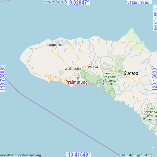
Praimutung GPS coordinates[2]
9° 43' 23.52" South, 119° 27' 22.32" East
| Map corner | latitude | longitude |
|---|---|---|
| Upper-left | -9.02947°, | 118.75308° |
| Center: | -9.7232°, | 119.4562° |
| Lower-right: | -10.41549°, | 120.15933° |
| Map W x H: | 154.1×154.1 km | = 95.8×95.8mi |
| max Lat: | 5.88969° ⇑95% North |
| Praimutung: | -9.7232° |
| min Lat: | ⇓5% South -10.934° |
| min Long | Praimutung | max Long |
| 95.1345° | 119.4562° | 140.9419° |
| W 81.8%⇐ | ⇒18.2% E |
Elevation
Elevation of Praimutung is 18 m = 59 ft, and this is 211.7 m = 695 ft below average elevation for this country.
| Max E: |
3185 m = 10449 ft | 80.9% |
| Avg. | 229.7 m = 754 ft | |
| Praimutung | 18 m = 59 ft | |
Min E: |
-1 m = -3 ft | 19.1% |
See also: Indonesia elevation on elevation.city.
Geographical zone
Praimutung is located in South Torrid zone (between Equator and Tropic of Capricorn). Distance of Equator is 1081.1 km =671.8 mi to North.| Distance of | km | miles | from Praimutung |
|---|---|---|---|
| Equator | 1081.1 | 671.8 | to North |
| Tropic Capricorn | 1524.8 | 947.5 | to South |
| Antarctic Circle | 6320.1 | 3927.1 | to South |
| South Pole | 8925.9 | 5546.3 | to South |


Nearby cities:
15 places around Praimutung: (largest is in red/bold)
• Barabedang
3.3 km =2.1 mi,  0°
0°
• Barakabita
10.5 km =6.5 mi,  270°
270°
• Kabukarudi
10.6 km =6.6 mi, 269°
• Kalimbukuni
9.9 km =6.2 mi,  347°
347°
• Kotawaikabubak
10.2 km =6.3 mi,  339°
339°
• Lahihagalang
0.3 km =0.2 mi,  293°
293°
• Litibakul
3.4 km =2.1 mi,  319°
319°
• Maledona
7.8 km =4.8 mi, 270°
• Ngaduloda
10.1 km =6.3 mi, 290°
• Padedewatu
6.6 km =4.1 mi,  245°
245°
• Puukadelu
9.5 km =5.9 mi,  327°
327°
• Tebara
10 km =6.2 mi, 343°
• Tibutana
10.5 km =6.5 mi, 341°
• Toupopu
2.8 km =1.7 mi,  36°
36°
• Waimadaka
5.2 km =3.2 mi, 288°
Sources, notices
• [Note1] Compared only with cities in Indonesia existing in our database
• [Src1] Map data: © OpenStreetMap contributors (CC-BY-SA)
• [Src2] Other city data from geonames.org with taken over terms of usage.
• [Src3] Geographical zone / Annual Mean Temperature by Robert A. Rohde @ Wikipedia
