Bayanan geodata
Bayanan (East Java) is a seat of a fourth-order administrative division; located in Indonesia in Asia/Jakarta (GMT+7) time zone. In our database, there are 407 cities with bigger population. Compared to other cities in Indonesia, 65.8% of cities are located further ↑North; 51.1% of cities are located further →East and 52.7% of cities have higher elevation than Bayanan. Note1


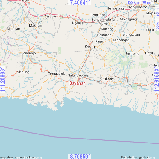
Bayanan GPS coordinates[2]
8° 6' 11.16" South, 111° 54' 46.08" East
| Map corner | latitude | longitude |
|---|---|---|
| Upper-left | -7.40641°, | 111.20968° |
| Center: | -8.1031°, | 111.9128° |
| Lower-right: | -8.79859°, | 112.61593° |
| Map W x H: | 154.8×154.8 km | = 96.2×96.2mi |
| max Lat: | 5.88969° ⇑65.8% North |
| Bayanan: | -8.1031° |
| min Lat: | ⇓34.2% South -10.934° |
| min Long | Bayanan | max Long |
| 95.1345° | 111.9128° | 140.9419° |
| W 48.9%⇐ | ⇒51.1% E |
Elevation
Elevation of Bayanan is 93 m = 305 ft, and this is 136.7 m = 448 ft below average elevation for this country.
| Max E: |
3185 m = 10449 ft | 52.7% |
| Avg. | 229.7 m = 754 ft | |
| Bayanan | 93 m = 305 ft | |
Min E: |
-1 m = -3 ft | 47.3% |
See also: Indonesia elevation on elevation.city.
Geographical zone
Bayanan is located in South Torrid zone (between Equator and Tropic of Capricorn). Distance of Equator is 901 km =559.9 mi to North.| Distance of | km | miles | from Bayanan |
|---|---|---|---|
| Equator | 901 | 559.9 | to North |
| Tropic Capricorn | 1704.9 | 1059.4 | to South |
| Antarctic Circle | 6500.2 | 4039 | to South |
| South Pole | 9106.1 | 5658.3 | to South |


Nearby cities:
15 places around Bayanan: (largest is in red/bold)
• Bendilmuning
3.4 km =2.1 mi,  69°
69°
• Boyolangu
2.7 km =1.7 mi,  231°
231°
• Doropayung
3.1 km =1.9 mi,  97°
97°
• Glodokan
2.7 km =1.7 mi,  185°
185°
• Jepun
3.1 km =1.9 mi,  355°
355°
• Karanggayam
0.4 km =0.2 mi,  328°
328°
• Kedungsinggil
0.6 km =0.4 mi,  40°
40°
• Kudusan
3.1 km =1.9 mi,  29°
29°
• Mojo
1.9 km =1.2 mi,  153°
153°
• Prayan
3.3 km =2.1 mi,  324°
324°
• Pucung Kidul
2.2 km =1.4 mi,  206°
206°
• Sanggrahan Kidul
2 km =1.2 mi,  173°
173°
• Serut
2.5 km =1.6 mi,  352°
352°
• Tanggulangin
2.5 km =1.6 mi, 35°
• Wajak
0.7 km =0.4 mi,  156°
156°
Sources, notices
• [Note1] Compared only with cities in Indonesia existing in our database
• [Src1] Map data: © OpenStreetMap contributors (CC-BY-SA)
• [Src2] Other city data from geonames.org with taken over terms of usage.
• [Src3] Geographical zone / Annual Mean Temperature by Robert A. Rohde @ Wikipedia
