Banyuanyar geodata
Banyuanyar (East Java) is a seat of a fourth-order administrative division; located in Indonesia in Asia/Jakarta (GMT+7) time zone. In our database, there are 407 cities with bigger population. Compared to other cities in Indonesia, 75.1% of cities are located further ↑North; 67.1% of cities are located further ←West and 84.2% of cities have lower elevation than Banyuanyar. Note1


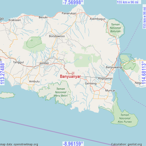
Banyuanyar GPS coordinates[2]
8° 15' 59.04" South, 113° 58' 40.8" East
| Map corner | latitude | longitude |
|---|---|---|
| Upper-left | -7.56998°, | 113.27488° |
| Center: | -8.2664°, | 113.978° |
| Lower-right: | -8.96159°, | 114.68113° |
| Map W x H: | 154.7×154.7 km | = 96.1×96.1mi |
| max Lat: | 5.88969° ⇑75.1% North |
| Banyuanyar: | -8.2664° |
| min Lat: | ⇓24.9% South -10.934° |
| min Long | Banyuanyar | max Long |
| 95.1345° | 113.978° | 140.9419° |
| W 67.1%⇐ | ⇒32.9% E |
Elevation
Elevation of Banyuanyar is 503 m = 1650 ft, and this is 273.3 m = 897 ft above average elevation for this country.
| Max E: |
3185 m = 10449 ft | 15.8% |
| Banyuanyar | 503 m 1650 ft | |
| Avg. | 229.7 m = 754 ft | |
Min E: |
-1 m = -3 ft | 84.2% |
See also: Indonesia elevation on elevation.city.
Geographical zone
Banyuanyar is located in South Torrid zone (between Equator and Tropic of Capricorn). Distance of Equator is 919.1 km =571.1 mi to North.| Distance of | km | miles | from Banyuanyar |
|---|---|---|---|
| Equator | 919.1 | 571.1 | to North |
| Tropic Capricorn | 1686.8 | 1048.1 | to South |
| Antarctic Circle | 6482 | 4027.7 | to South |
| South Pole | 9087.9 | 5647 | to South |


Nearby cities:
15 places around Banyuanyar: (largest is in red/bold)
• Garahan
11.2 km =7 mi,  302°
302°
• Kalibaru
2.7 km =1.7 mi,  161°
161°
• Kalibaru Kulon
2.4 km =1.5 mi,  177°
177°
• Karangarjo
9.3 km =5.8 mi,  123°
123°
• Karangharjo
15.7 km =9.8 mi,  275°
275°
• Karangharjo Kidul
9.3 km =5.8 mi, 123°
• Krajan Tengah
7.3 km =4.5 mi, 124°
• Purwojoyo
15.1 km =9.4 mi, 118°
• Sepanjang
9 km =5.6 mi, 115°
• Sidomulyo
7.2 km =4.5 mi,  310°
310°
• Silo
14.8 km =9.2 mi,  292°
292°
• Sukmoilang
13.3 km =8.3 mi,  271°
271°
• Sumberjati
13.9 km =8.6 mi, 309°
• Sumbersalak
15.9 km =9.9 mi,  319°
319°
• Tegalpakis
4 km =2.5 mi, 155°
Sources, notices
• [Note1] Compared only with cities in Indonesia existing in our database
• [Src1] Map data: © OpenStreetMap contributors (CC-BY-SA)
• [Src2] Other city data from geonames.org with taken over terms of usage.
• [Src3] Geographical zone / Annual Mean Temperature by Robert A. Rohde @ Wikipedia
