Tanahwurung geodata
Tanahwurung (East Nusa Tenggara) is a seat of a fourth-order administrative division; located in Indonesia in Asia/Makassar (GMT+8) time zone. In our database, there are 407 cities with bigger population. Compared to other cities in Indonesia, 94.6% of cities are located further ↑North; 83.6% of cities are located further ←West and 74.9% of cities have higher elevation than Tanahwurung. Note1


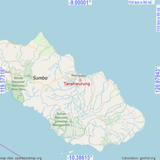
Tanahwurung GPS coordinates[2]
9° 41' 37.68" South, 120° 16' 34.68" East
| Map corner | latitude | longitude |
|---|---|---|
| Upper-left | -9.00001°, | 119.57318° |
| Center: | -9.6938°, | 120.2763° |
| Lower-right: | -10.38615°, | 120.97943° |
| Map W x H: | 154.1×154.1 km | = 95.8×95.8mi |
| max Lat: | 5.88969° ⇑94.6% North |
| Tanahwurung: | -9.6938° |
| min Lat: | ⇓5.4% South -10.934° |
| min Long | Tanahwurung | max Long |
| 95.1345° | 120.2763° | 140.9419° |
| W 83.6%⇐ | ⇒16.4% E |
Elevation
Elevation of Tanahwurung is 25 m = 82 ft, and this is 204.7 m = 672 ft below average elevation for this country.
| Max E: |
3185 m = 10449 ft | 74.9% |
| Avg. | 229.7 m = 754 ft | |
| Tanahwurung | 25 m = 82 ft | |
Min E: |
-1 m = -3 ft | 25.1% |
See also: Indonesia elevation on elevation.city.
Geographical zone
Tanahwurung is located in South Torrid zone (between Equator and Tropic of Capricorn). Distance of Equator is 1077.8 km =669.7 mi to North.| Distance of | km | miles | from Tanahwurung |
|---|---|---|---|
| Equator | 1077.8 | 669.7 | to North |
| Tropic Capricorn | 1528.1 | 949.5 | to South |
| Antarctic Circle | 6323.3 | 3929.1 | to South |
| South Pole | 8929.2 | 5548.3 | to South |


Nearby cities:
15 places around Tanahwurung: (largest is in red/bold)
• Apuhambati
6.7 km =4.2 mi,  241°
241°
• Bidikotak
18.5 km =11.5 mi,  213°
213°
• Kabandang
6.3 km =3.9 mi, 205°
• Kamalaputi
5.2 km =3.2 mi,  344°
344°
• Karara
6.2 km =3.9 mi,  322°
322°
• Kawangu
7.5 km =4.7 mi,  71°
71°
• Kawangu Satu
5.9 km =3.7 mi, 72°
• Landa
12.7 km =7.9 mi,  332°
332°
• Mangga Dua
3.9 km =2.4 mi,  27°
27°
• Palindi
5.7 km =3.5 mi,  108°
108°
• Penang
17.1 km =10.6 mi,  191°
191°
• Tanabara
1.7 km =1.1 mi,  78°
78°
• Umburarameha
4.8 km =3 mi,  314°
314°
• Waingapu
4.3 km =2.7 mi, 342°
• Wairinding
16.2 km =10.1 mi,  277°
277°
Sources, notices
• [Note1] Compared only with cities in Indonesia existing in our database
• [Src1] Map data: © OpenStreetMap contributors (CC-BY-SA)
• [Src2] Other city data from geonames.org with taken over terms of usage.
• [Src3] Geographical zone / Annual Mean Temperature by Robert A. Rohde @ Wikipedia
