Senanghati geodata
Senanghati (Banten) is a seat of a fourth-order administrative division; located in Indonesia in Asia/Jakarta (GMT+7) time zone. In our database, there are 407 cities with bigger population. Compared to other cities in Indonesia, 79.8% of cities are located further ↓South; 91.6% of cities are located further →East and 55.3% of cities have higher elevation than Senanghati. Note1


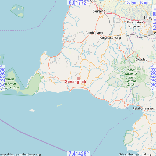
Senanghati GPS coordinates[2]
6° 42' 59.4" South, 105° 57' 45.72" East
| Map corner | latitude | longitude |
|---|---|---|
| Upper-left | -6.01772°, | 105.25958° |
| Center: | -6.7165°, | 105.9627° |
| Lower-right: | -7.41428°, | 106.66583° |
| Map W x H: | 155.3×155.3 km | = 96.5×96.5mi |
| max Lat: | 5.88969° ⇑20.2% North |
| Senanghati: | -6.7165° |
| min Lat: | ⇓79.8% South -10.934° |
| min Long | Senanghati | max Long |
| 95.1345° | 105.9627° | 140.9419° |
| W 8.4%⇐ | ⇒91.6% E |
Elevation
Elevation of Senanghati is 83 m = 272 ft, and this is 146.7 m = 481 ft below average elevation for this country.
| Max E: |
3185 m = 10449 ft | 55.3% |
| Avg. | 229.7 m = 754 ft | |
| Senanghati | 83 m = 272 ft | |
Min E: |
-1 m = -3 ft | 44.7% |
See also: Indonesia elevation on elevation.city.
Geographical zone
Senanghati is located in South Torrid zone (between Equator and Tropic of Capricorn). Distance of Equator is 746.8 km =464 mi to North.| Distance of | km | miles | from Senanghati |
|---|---|---|---|
| Equator | 746.8 | 464 | to North |
| Tropic Capricorn | 1859.1 | 1155.2 | to South |
| Antarctic Circle | 6654.4 | 4134.9 | to South |
| South Pole | 9260.3 | 5754.1 | to South |


Nearby cities:
15 places around Senanghati: (largest is in red/bold)
• Babakan
6.4 km =4 mi,  257°
257°
• Barengkok Hilir
7 km =4.3 mi,  218°
218°
• Bolang
6.4 km =4 mi,  148°
148°
• Bunut
5.8 km =3.6 mi, 255°
• Cikarang
4.7 km =2.9 mi,  270°
270°
• Cikeusikdesa
4.3 km =2.7 mi,  193°
193°
• Cipaas
6.6 km =4.1 mi,  282°
282°
• Daleum
4 km =2.5 mi,  169°
169°
• Gintung Utara
2.3 km =1.4 mi,  130°
130°
• Kampungsawah
4.8 km =3 mi,  17°
17°
• Pagenggang Selatan
4.4 km =2.7 mi,  143°
143°
• Pamundayan Kaler
7.2 km =4.5 mi,  72°
72°
• Parungrasa
4.6 km =2.9 mi,  248°
248°
• Perumahan Kopi
4.4 km =2.7 mi,  357°
357°
• Sanghiang
6.9 km =4.3 mi, 140°
Sources, notices
• [Note1] Compared only with cities in Indonesia existing in our database
• [Src1] Map data: © OpenStreetMap contributors (CC-BY-SA)
• [Src2] Other city data from geonames.org with taken over terms of usage.
• [Src3] Geographical zone / Annual Mean Temperature by Robert A. Rohde @ Wikipedia
