Kampungsawah geodata
Kampungsawah (Banten) is a seat of a fourth-order administrative division; located in Indonesia in Asia/Jakarta (GMT+7) time zone. In our database, there are 407 cities with bigger population. Compared to other cities in Indonesia, 81.3% of cities are located further ↓South; 91.4% of cities are located further →East and 57.1% of cities have higher elevation than Kampungsawah. Note1


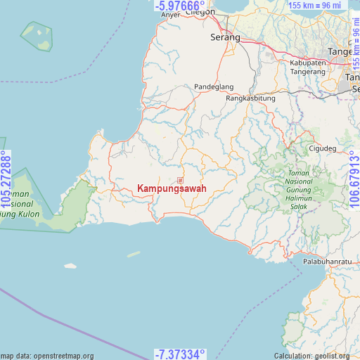
Kampungsawah GPS coordinates[2]
6° 40' 31.8" South, 105° 58' 33.6" East
| Map corner | latitude | longitude |
|---|---|---|
| Upper-left | -5.97666°, | 105.27288° |
| Center: | -6.6755°, | 105.976° |
| Lower-right: | -7.37334°, | 106.67913° |
| Map W x H: | 155.3×155.3 km | = 96.5×96.5mi |
| max Lat: | 5.88969° ⇑18.7% North |
| Kampungsawah: | -6.6755° |
| min Lat: | ⇓81.3% South -10.934° |
| min Long | Kampungsawah | max Long |
| 95.1345° | 105.976° | 140.9419° |
| W 8.6%⇐ | ⇒91.4% E |
Elevation
Elevation of Kampungsawah is 72 m = 236 ft, and this is 157.7 m = 517 ft below average elevation for this country.
| Max E: |
3185 m = 10449 ft | 57.1% |
| Avg. | 229.7 m = 754 ft | |
| Kampungsawah | 72 m = 236 ft | |
Min E: |
-1 m = -3 ft | 42.9% |
See also: Indonesia elevation on elevation.city.
Geographical zone
Kampungsawah is located in South Torrid zone (between Equator and Tropic of Capricorn). Distance of Equator is 742.2 km =461.2 mi to North.| Distance of | km | miles | from Kampungsawah |
|---|---|---|---|
| Equator | 742.2 | 461.2 | to North |
| Tropic Capricorn | 1863.7 | 1158 | to South |
| Antarctic Circle | 6658.9 | 4137.6 | to South |
| South Pole | 9264.8 | 5756.9 | to South |


Nearby cities:
15 places around Kampungsawah: (largest is in red/bold)
• Anggrik
6 km =3.7 mi,  8°
8°
• Bulakan
7.1 km =4.4 mi,  61°
61°
• Cikarang
7.7 km =4.8 mi,  233°
233°
• Cipaas
8.5 km =5.3 mi,  248°
248°
• Ciseda
4.7 km =2.9 mi,  16°
16°
• Curuglanglang
8 km =5 mi,  309°
309°
• Daleum
8.5 km =5.3 mi,  185°
185°
• Gintung Utara
6 km =3.7 mi,  177°
177°
• Manggu
7.5 km =4.7 mi,  2°
2°
• Pagenggang Selatan
8.2 km =5.1 mi,  171°
171°
• Pamundayan Kaler
5.9 km =3.7 mi,  113°
113°
• Panacaran
6 km =3.7 mi,  286°
286°
• Parungrasa
8.5 km =5.3 mi,  222°
222°
• Perumahan Kopi
1.7 km =1.1 mi,  264°
264°
• Senanghati
4.8 km =3 mi,  197°
197°
Sources, notices
• [Note1] Compared only with cities in Indonesia existing in our database
• [Src1] Map data: © OpenStreetMap contributors (CC-BY-SA)
• [Src2] Other city data from geonames.org with taken over terms of usage.
• [Src3] Geographical zone / Annual Mean Temperature by Robert A. Rohde @ Wikipedia
