Balekersukamaju geodata
Balekersukamaju (Banten) is a seat of a fourth-order administrative division; located in Indonesia in Asia/Jakarta (GMT+7) time zone. In our database, there are 407 cities with bigger population. Compared to other cities in Indonesia, 85.6% of cities are located further ↓South; 93.4% of cities are located further →East and 77.1% of cities have higher elevation than Balekersukamaju. Note1


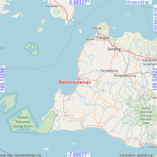
Balekersukamaju GPS coordinates[2]
6° 22' 57" South, 105° 50' 9.96" East
| Map corner | latitude | longitude |
|---|---|---|
| Upper-left | -5.68327°, | 105.13298° |
| Center: | -6.3825°, | 105.8361° |
| Lower-right: | -7.08077°, | 106.53923° |
| Map W x H: | 155.4×155.4 km | = 96.6×96.6mi |
| max Lat: | 5.88969° ⇑14.4% North |
| Balekersukamaju: | -6.3825° |
| min Lat: | ⇓85.6% South -10.934° |
| min Long | Balekersukamaju | max Long |
| 95.1345° | 105.8361° | 140.9419° |
| W 6.6%⇐ | ⇒93.4% E |
Elevation
Elevation of Balekersukamaju is 22 m = 72 ft, and this is 207.7 m = 681 ft below average elevation for this country.
| Max E: |
3185 m = 10449 ft | 77.1% |
| Avg. | 229.7 m = 754 ft | |
| Balekersukamaju | 22 m = 72 ft | |
Min E: |
-1 m = -3 ft | 22.9% |
See also: Indonesia elevation on elevation.city.
Geographical zone
Balekersukamaju is located in South Torrid zone (between Equator and Tropic of Capricorn). Distance of Equator is 709.7 km =441 mi to North.| Distance of | km | miles | from Balekersukamaju |
|---|---|---|---|
| Equator | 709.7 | 441 | to North |
| Tropic Capricorn | 1896.3 | 1178.3 | to South |
| Antarctic Circle | 6691.5 | 4157.9 | to South |
| South Pole | 9297.4 | 5777.1 | to South |


Nearby cities:
15 places around Balekersukamaju: (largest is in red/bold)
• Badur
1.3 km =0.8 mi,  79°
79°
• Kadugadung
2.5 km =1.6 mi,  117°
117°
• Kadupayung
2 km =1.2 mi,  141°
141°
• Kampunglistrik
0.9 km =0.6 mi,  304°
304°
• Labuan
0.8 km =0.5 mi, 304°
• Lantera
1.5 km =0.9 mi,  289°
289°
• Makui
1.2 km =0.7 mi,  332°
332°
• Padahayu
3 km =1.9 mi,  67°
67°
• Pangampoan
2.5 km =1.6 mi, 136°
• Picungbera
3.3 km =2.1 mi,  15°
15°
• Sepenmasjid
2.1 km =1.3 mi,  37°
37°
• Tarogong
1.2 km =0.7 mi,  164°
164°
• Tegalpanjang
3.3 km =2.1 mi,  193°
193°
• Teluk
1.7 km =1.1 mi,  313°
313°
• Tenjolahang Timur
3.7 km =2.3 mi, 36°
Sources, notices
• [Note1] Compared only with cities in Indonesia existing in our database
• [Src1] Map data: © OpenStreetMap contributors (CC-BY-SA)
• [Src2] Other city data from geonames.org with taken over terms of usage.
• [Src3] Geographical zone / Annual Mean Temperature by Robert A. Rohde @ Wikipedia
