Sepenmasjid geodata
Sepenmasjid (Banten) is a seat of a fourth-order administrative division; located in Indonesia in Asia/Jakarta (GMT+7) time zone. In our database, there are 407 cities with bigger population. Compared to other cities in Indonesia, 85.9% of cities are located further ↓South; 93.2% of cities are located further →East and 63.2% of cities have higher elevation than Sepenmasjid. Note1


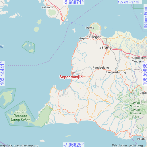
Sepenmasjid GPS coordinates[2]
6° 22' 4.656" South, 105° 50' 51.108" East
| Map corner | latitude | longitude |
|---|---|---|
| Upper-left | -5.66871°, | 105.14441° |
| Center: | -6.36796°, | 105.84753° |
| Lower-right: | -7.06625°, | 106.55066° |
| Map W x H: | 155.4×155.4 km | = 96.6×96.6mi |
| max Lat: | 5.88969° ⇑14.1% North |
| Sepenmasjid: | -6.36796° |
| min Lat: | ⇓85.9% South -10.934° |
| min Long | Sepenmasjid | max Long |
| 95.1345° | 105.84753° | 140.9419° |
| W 6.8%⇐ | ⇒93.2% E |
Elevation
Elevation of Sepenmasjid is 48 m = 157 ft, and this is 181.7 m = 596 ft below average elevation for this country.
| Max E: |
3185 m = 10449 ft | 63.2% |
| Avg. | 229.7 m = 754 ft | |
| Sepenmasjid | 48 m = 157 ft | |
Min E: |
-1 m = -3 ft | 36.8% |
See also: Indonesia elevation on elevation.city.
Geographical zone
Sepenmasjid is located in South Torrid zone (between Equator and Tropic of Capricorn). Distance of Equator is 708.1 km =440 mi to North.| Distance of | km | miles | from Sepenmasjid |
|---|---|---|---|
| Equator | 708.1 | 440 | to North |
| Tropic Capricorn | 1897.9 | 1179.3 | to South |
| Antarctic Circle | 6693.1 | 4158.9 | to South |
| South Pole | 9299 | 5778.1 | to South |


Nearby cities:
15 places around Sepenmasjid: (largest is in red/bold)
• Badur
1.4 km =0.9 mi,  180°
180°
• Balekersukamaju
2.1 km =1.3 mi,  217°
217°
• Kaducondong
2.5 km =1.6 mi,  19°
19°
• Kadugadung
2.9 km =1.8 mi,  160°
160°
• Kampunglistrik
2.3 km =1.4 mi,  241°
241°
• Labuan
2.3 km =1.4 mi, 239°
• Lantera
2.9 km =1.8 mi,  247°
247°
• Makui
1.9 km =1.2 mi, 252°
• Padahayu
1.6 km =1 mi,  107°
107°
• Picungbera
1.6 km =1 mi,  347°
347°
• Sarampu
2.5 km =1.6 mi,  80°
80°
• Sukacai Tengah
2.7 km =1.7 mi,  47°
47°
• Tarogong
2.9 km =1.8 mi,  198°
198°
• Teluk
2.5 km =1.6 mi,  259°
259°
• Tenjolahang Timur
1.7 km =1.1 mi,  34°
34°
Sources, notices
• [Note1] Compared only with cities in Indonesia existing in our database
• [Src1] Map data: © OpenStreetMap contributors (CC-BY-SA)
• [Src2] Other city data from geonames.org with taken over terms of usage.
• [Src3] Geographical zone / Annual Mean Temperature by Robert A. Rohde @ Wikipedia
