Kasepen geodata
Kasepen (Banten) is a seat of a fourth-order administrative division; located in Indonesia in Asia/Jakarta (GMT+7) time zone. In our database, there are 407 cities with bigger population. Compared to other cities in Indonesia, 86.7% of cities are located further ↓South; 93.3% of cities are located further →East and 97.2% of cities have higher elevation than Kasepen. Note1


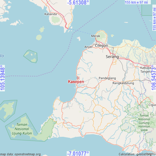
Kasepen GPS coordinates[2]
6° 18' 44.64" South, 105° 50' 33.36" East
| Map corner | latitude | longitude |
|---|---|---|
| Upper-left | -5.61308°, | 105.13948° |
| Center: | -6.3124°, | 105.8426° |
| Lower-right: | -7.01077°, | 106.54573° |
| Map W x H: | 155.4×155.4 km | = 96.6×96.6mi |
| max Lat: | 5.88969° ⇑13.3% North |
| Kasepen: | -6.3124° |
| min Lat: | ⇓86.7% South -10.934° |
| min Long | Kasepen | max Long |
| 95.1345° | 105.8426° | 140.9419° |
| W 6.7%⇐ | ⇒93.3% E |
Elevation
Elevation of Kasepen is 6 m = 20 ft, and this is 223.7 m = 734 ft below average elevation for this country.
| Max E: |
3185 m = 10449 ft | 97.2% |
| Avg. | 229.7 m = 754 ft | |
| Kasepen | 6 m = 20 ft | |
Min E: |
-1 m = -3 ft | 2.8% |
See also: Indonesia elevation on elevation.city.
Geographical zone
Kasepen is located in South Torrid zone (between Equator and Tropic of Capricorn). Distance of Equator is 701.9 km =436.1 mi to North.| Distance of | km | miles | from Kasepen |
|---|---|---|---|
| Equator | 701.9 | 436.1 | to North |
| Tropic Capricorn | 1904 | 1183.1 | to South |
| Antarctic Circle | 6699.3 | 4162.8 | to South |
| South Pole | 9305.2 | 5782 | to South |


Nearby cities:
15 places around Kasepen: (largest is in red/bold)
• Bogor
3.5 km =2.2 mi,  126°
126°
• Caringin Lor
4.5 km =2.8 mi,  201°
201°
• Carita
0.8 km =0.5 mi,  219°
219°
• Cibango
3.7 km =2.3 mi, 195°
• Citajur
3.5 km =2.2 mi,  331°
331°
• Janaka
4.3 km =2.7 mi,  96°
96°
• Kaducondong
4.1 km =2.5 mi,  160°
160°
• Pamatang
2.1 km =1.3 mi,  205°
205°
• Panghadangan
6.1 km =3.8 mi,  82°
82°
• Picungbera
4.6 km =2.9 mi,  177°
177°
• Sukacai
4.8 km =3 mi,  146°
146°
• Sukacai Tengah
5 km =3.1 mi, 150°
• Tangkil
0.9 km =0.6 mi,  110°
110°
• Tembol
1.1 km =0.7 mi, 179°
• Tenjolahang Timur
5 km =3.1 mi, 162°
Sources, notices
• [Note1] Compared only with cities in Indonesia existing in our database
• [Src1] Map data: © OpenStreetMap contributors (CC-BY-SA)
• [Src2] Other city data from geonames.org with taken over terms of usage.
• [Src3] Geographical zone / Annual Mean Temperature by Robert A. Rohde @ Wikipedia
