Gobang geodata
Gobang (Banten) is a seat of a fourth-order administrative division; located in Indonesia in Asia/Jakarta (GMT+7) time zone. In our database, there are 407 cities with bigger population. Compared to other cities in Indonesia, 85.8% of cities are located further ↓South; 91% of cities are located further →East and 61.2% of cities have lower elevation than Gobang. Note1


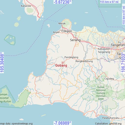
Gobang GPS coordinates[2]
6° 22' 17.76" South, 106° 0' 25.92" East
| Map corner | latitude | longitude |
|---|---|---|
| Upper-left | -5.67236°, | 105.30408° |
| Center: | -6.3716°, | 106.0072° |
| Lower-right: | -7.06989°, | 106.71033° |
| Map W x H: | 155.4×155.4 km | = 96.6×96.6mi |
| max Lat: | 5.88969° ⇑14.2% North |
| Gobang: | -6.3716° |
| min Lat: | ⇓85.8% South -10.934° |
| min Long | Gobang | max Long |
| 95.1345° | 106.0072° | 140.9419° |
| W 9%⇐ | ⇒91% E |
Elevation
Elevation of Gobang is 177 m = 581 ft, and this is 52.7 m = 173 ft below average elevation for this country.
| Max E: |
3185 m = 10449 ft | 38.8% |
| Avg. | 229.7 m = 754 ft | |
| Gobang | 177 m = 581 ft | |
Min E: |
-1 m = -3 ft | 61.2% |
See also: Indonesia elevation on elevation.city.
Geographical zone
Gobang is located in South Torrid zone (between Equator and Tropic of Capricorn). Distance of Equator is 708.5 km =440.2 mi to North.| Distance of | km | miles | from Gobang |
|---|---|---|---|
| Equator | 708.5 | 440.2 | to North |
| Tropic Capricorn | 1897.5 | 1179.1 | to South |
| Antarctic Circle | 6692.7 | 4158.6 | to South |
| South Pole | 9298.6 | 5777.9 | to South |


Nearby cities:
15 places around Gobang: (largest is in red/bold)
• Cikaduen
2.3 km =1.4 mi,  188°
188°
• Cimongkor
2.1 km =1.3 mi,  66°
66°
• Gajahmada
1 km =0.6 mi,  144°
144°
• Kadugadung
1.8 km =1.1 mi, 137°
• Koncang
3.6 km =2.2 mi,  169°
169°
• Parigi
1.8 km =1.1 mi,  291°
291°
• Parigi
3.2 km =2 mi,  39°
39°
• Parumasan Timur
2.9 km =1.8 mi,  127°
127°
• Saketi
3.7 km =2.3 mi,  207°
207°
• Saketipasar
3.6 km =2.2 mi,  203°
203°
• Saketipasir
3.3 km =2.1 mi, 208°
• Sekong
3 km =1.9 mi,  99°
99°
• Sobong
1.1 km =0.7 mi, 165°
• Tarikolot
1.5 km =0.9 mi,  49°
49°
• Timbang
3.3 km =2.1 mi,  239°
239°
Sources, notices
• [Note1] Compared only with cities in Indonesia existing in our database
• [Src1] Map data: © OpenStreetMap contributors (CC-BY-SA)
• [Src2] Other city data from geonames.org with taken over terms of usage.
• [Src3] Geographical zone / Annual Mean Temperature by Robert A. Rohde @ Wikipedia
