Kupahandap geodata
Kupahandap (Banten) is a seat of a fourth-order administrative division; located in Indonesia in Asia/Jakarta (GMT+7) time zone. In our database, there are 407 cities with bigger population. Compared to other cities in Indonesia, 85.7% of cities are located further ↓South; 92% of cities are located further →East and 57.5% of cities have lower elevation than Kupahandap. Note1


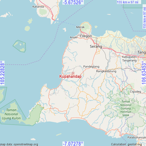
Kupahandap GPS coordinates[2]
6° 22' 28.2" South, 105° 55' 53.04" East
| Map corner | latitude | longitude |
|---|---|---|
| Upper-left | -5.67526°, | 105.22828° |
| Center: | -6.3745°, | 105.9314° |
| Lower-right: | -7.07278°, | 106.63453° |
| Map W x H: | 155.4×155.4 km | = 96.6×96.6mi |
| max Lat: | 5.88969° ⇑14.3% North |
| Kupahandap: | -6.3745° |
| min Lat: | ⇓85.7% South -10.934° |
| min Long | Kupahandap | max Long |
| 95.1345° | 105.9314° | 140.9419° |
| W 8%⇐ | ⇒92% E |
Elevation
Elevation of Kupahandap is 142 m = 466 ft, and this is 87.7 m = 288 ft below average elevation for this country.
| Max E: |
3185 m = 10449 ft | 42.5% |
| Avg. | 229.7 m = 754 ft | |
| Kupahandap | 142 m = 466 ft | |
Min E: |
-1 m = -3 ft | 57.5% |
See also: Indonesia elevation on elevation.city.
Geographical zone
Kupahandap is located in South Torrid zone (between Equator and Tropic of Capricorn). Distance of Equator is 708.8 km =440.4 mi to North.| Distance of | km | miles | from Kupahandap |
|---|---|---|---|
| Equator | 708.8 | 440.4 | to North |
| Tropic Capricorn | 1897.1 | 1178.8 | to South |
| Antarctic Circle | 6692.4 | 4158.5 | to South |
| South Pole | 9298.3 | 5777.7 | to South |


Nearby cities:
15 places around Kupahandap: (largest is in red/bold)
• Bojongpinang
2.2 km =1.4 mi,  46°
46°
• Bongbong
3 km =1.9 mi,  137°
137°
• Cigandeng
0.6 km =0.4 mi,  345°
345°
• Ciherang
2 km =1.2 mi,  88°
88°
• Kadubeureum
2 km =1.2 mi,  34°
34°
• Kaducukang
2.5 km =1.6 mi,  215°
215°
• Kadupager
2.9 km =1.8 mi,  8°
8°
• Kaduranca
1.5 km =0.9 mi, 353°
• Kebonjeruk
1.9 km =1.2 mi,  212°
212°
• Leuweungkolot
2 km =1.2 mi,  188°
188°
• Manungtung
1.4 km =0.9 mi,  109°
109°
• Menes
1.4 km =0.9 mi,  265°
265°
• Pasargunung
2.6 km =1.6 mi,  62°
62°
• Sorodot
2.5 km =1.6 mi,  303°
303°
• Sukamara
1.2 km =0.7 mi,  124°
124°
Sources, notices
• [Note1] Compared only with cities in Indonesia existing in our database
• [Src1] Map data: © OpenStreetMap contributors (CC-BY-SA)
• [Src2] Other city data from geonames.org with taken over terms of usage.
• [Src3] Geographical zone / Annual Mean Temperature by Robert A. Rohde @ Wikipedia
