Leuweungkolot geodata
Leuweungkolot (Banten) is a seat of a fourth-order administrative division; located in Indonesia in Asia/Jakarta (GMT+7) time zone. In our database, there are 407 cities with bigger population. Compared to other cities in Indonesia, 85.5% of cities are located further ↓South; 92% of cities are located further →East and 52.7% of cities have higher elevation than Leuweungkolot. Note1


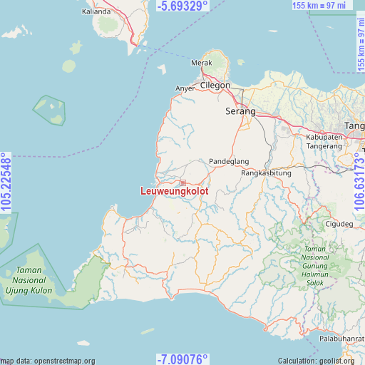
Leuweungkolot GPS coordinates[2]
6° 23' 33" South, 105° 55' 42.96" East
| Map corner | latitude | longitude |
|---|---|---|
| Upper-left | -5.69329°, | 105.22548° |
| Center: | -6.3925°, | 105.9286° |
| Lower-right: | -7.09076°, | 106.63173° |
| Map W x H: | 155.4×155.4 km | = 96.6×96.6mi |
| max Lat: | 5.88969° ⇑14.5% North |
| Leuweungkolot: | -6.3925° |
| min Lat: | ⇓85.5% South -10.934° |
| min Long | Leuweungkolot | max Long |
| 95.1345° | 105.9286° | 140.9419° |
| W 8%⇐ | ⇒92% E |
Elevation
Elevation of Leuweungkolot is 93 m = 305 ft, and this is 136.7 m = 448 ft below average elevation for this country.
| Max E: |
3185 m = 10449 ft | 52.7% |
| Avg. | 229.7 m = 754 ft | |
| Leuweungkolot | 93 m = 305 ft | |
Min E: |
-1 m = -3 ft | 47.3% |
See also: Indonesia elevation on elevation.city.
Geographical zone
Leuweungkolot is located in South Torrid zone (between Equator and Tropic of Capricorn). Distance of Equator is 710.8 km =441.7 mi to North.| Distance of | km | miles | from Leuweungkolot |
|---|---|---|---|
| Equator | 710.8 | 441.7 | to North |
| Tropic Capricorn | 1895.1 | 1177.6 | to South |
| Antarctic Circle | 6690.4 | 4157.2 | to South |
| South Pole | 9296.3 | 5776.5 | to South |


Nearby cities:
15 places around Leuweungkolot: (largest is in red/bold)
• Bongbong
2.3 km =1.4 mi,  94°
94°
• Cigandeng
2.6 km =1.6 mi,  3°
3°
• Ciherang
3.1 km =1.9 mi,  47°
47°
• Cikiray
3.4 km =2.1 mi,  295°
295°
• Kaducukang
1.2 km =0.7 mi,  267°
267°
• Kaduranca
3.5 km =2.2 mi, 2°
• Kebonjeruk
0.8 km =0.5 mi, 300°
• Kubangkondanglapangan
3.1 km =1.9 mi,  215°
215°
• Kupahandap
2 km =1.2 mi,  8°
8°
• Legokkopra
3.4 km =2.1 mi,  98°
98°
• Manungtung
2.2 km =1.4 mi, 46°
• Menes
2.2 km =1.4 mi,  329°
329°
• Pasirtundun
3.4 km =2.1 mi,  135°
135°
• Pasirwaringin
2.4 km =1.5 mi, 143°
• Sukamara
1.8 km =1.1 mi, 45°
Sources, notices
• [Note1] Compared only with cities in Indonesia existing in our database
• [Src1] Map data: © OpenStreetMap contributors (CC-BY-SA)
• [Src2] Other city data from geonames.org with taken over terms of usage.
• [Src3] Geographical zone / Annual Mean Temperature by Robert A. Rohde @ Wikipedia
