Lebakgempol geodata
Lebakgempol (Banten) is a seat of a fourth-order administrative division; located in Indonesia in Asia/Jakarta (GMT+7) time zone. In our database, there are 407 cities with bigger population. Compared to other cities in Indonesia, 84.7% of cities are located further ↓South; 89.7% of cities are located further →East and 55.3% of cities have higher elevation than Lebakgempol. Note1


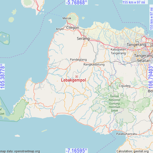
Lebakgempol GPS coordinates[2]
6° 28' 4.08" South, 106° 5' 27.24" East
| Map corner | latitude | longitude |
|---|---|---|
| Upper-left | -5.76868°, | 105.38778° |
| Center: | -6.4678°, | 106.0909° |
| Lower-right: | -7.16595°, | 106.79403° |
| Map W x H: | 155.4×155.4 km | = 96.6×96.6mi |
| max Lat: | 5.88969° ⇑15.3% North |
| Lebakgempol: | -6.4678° |
| min Lat: | ⇓84.7% South -10.934° |
| min Long | Lebakgempol | max Long |
| 95.1345° | 106.0909° | 140.9419° |
| W 10.3%⇐ | ⇒89.7% E |
Elevation
Elevation of Lebakgempol is 83 m = 272 ft, and this is 146.7 m = 481 ft below average elevation for this country.
| Max E: |
3185 m = 10449 ft | 55.3% |
| Avg. | 229.7 m = 754 ft | |
| Lebakgempol | 83 m = 272 ft | |
Min E: |
-1 m = -3 ft | 44.7% |
See also: Indonesia elevation on elevation.city.
Geographical zone
Lebakgempol is located in South Torrid zone (between Equator and Tropic of Capricorn). Distance of Equator is 719.2 km =446.9 mi to North.| Distance of | km | miles | from Lebakgempol |
|---|---|---|---|
| Equator | 719.2 | 446.9 | to North |
| Tropic Capricorn | 1886.8 | 1172.4 | to South |
| Antarctic Circle | 6682 | 4152 | to South |
| South Pole | 9287.9 | 5771.2 | to South |


Nearby cities:
15 places around Lebakgempol: (largest is in red/bold)
• Cahayamekar
7.7 km =4.8 mi,  228°
228°
• Cibeureum Satu
7.6 km =4.7 mi,  11°
11°
• Cigembor
6.8 km =4.2 mi,  298°
298°
• Gemuruh
3.2 km =2 mi,  356°
356°
• Kadungabaris
7 km =4.3 mi, 359°
• Kadusimbar
5.1 km =3.2 mi, 357°
• Kaum
3 km =1.9 mi,  112°
112°
• Keboncau
6.1 km =3.8 mi,  168°
168°
• Kopi
4.7 km =2.9 mi,  310°
310°
• Parag
7.2 km =4.5 mi,  261°
261°
• Sajir
4.4 km =2.7 mi,  187°
187°
• Sarageni
3.5 km =2.2 mi,  85°
85°
• Sidamukti
4.2 km =2.6 mi,  293°
293°
• Tajur
7 km =4.3 mi, 192°
• Umbul
2.5 km =1.6 mi, 5°
Sources, notices
• [Note1] Compared only with cities in Indonesia existing in our database
• [Src1] Map data: © OpenStreetMap contributors (CC-BY-SA)
• [Src2] Other city data from geonames.org with taken over terms of usage.
• [Src3] Geographical zone / Annual Mean Temperature by Robert A. Rohde @ Wikipedia
